A Dartmeet Dawdle
Reservoir bogs, a host of hut circles and seeing the leat before visiting a charming chapel.
“Dartmoor Over the Hill Hikes” (OTHHs) are designed for older walkers, like me, and reflect three of my passions – churches, pubs and Dartmoor’s fascinating past. An explanation of why I adopted these themes can be found here .
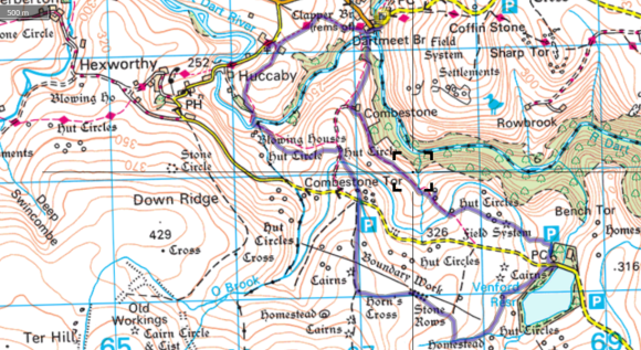
This walk starts from the tourist honey-pot of Dartmeet, on the East Dart River just upstream from its confluence with the West Dart. It’s a varied ramble providing some fine panoramic views and visiting rivers, leats, and a host of antiquities and relics of the moor’s more recent industrial past.
| START/ FINISH | Dartmeet, at the large national park authority car park (OS grid ref. SX672732). |
| DISTANCE | 5.8 miles |
| ASCENT | 937 ft |
| TERRAIN | Generally good underfoot on decent footpaths (not all shown on the OS map), with a little cross-country walking on Holne Moor in search of pre-historic antiquities. But, the walk is best done after a period of dry weather, otherwise the two sets of stepping stones crossed during the walk may be submerged. |
| PUB | The Forest Inn, Hexworthy (655726). |
Before leaving Dartmeet, it’s worth lingering a while to savour this picturesque beauty spot. According to Samuel Rowe in his “A perambulation of Dartmoor” the clapper bridge was originally built in medieval times and was a “Cyclopean” bridge similar to that found at Postbridge. It was destroyed long ago by what Rowe calls “an inundation of the Dart” but re-erected in 1888 by the Committee of the Dartmoor Preservation Association. The “new” road bridge next to the remains of the clapper bridge is in fact no spring chicken, being built in 1792.
Dartmeet is an official “put-in” spot for white water kayakers and canoeists traversing the upper section of the Dart, too many of whom have sadly lost their lives in the challenging stretch of river between here and Holne Bridge.
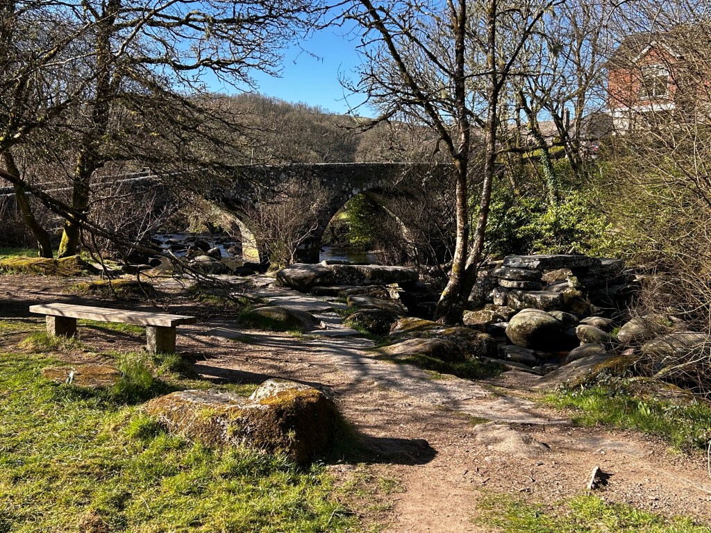
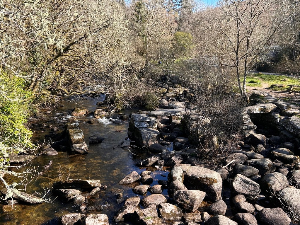
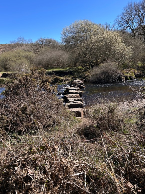
After taking the mandatory picture of the bridges, it’s time to start walking. Leaving the car park, we cross over the road bridge and almost immediately turn left down a narrow path running alongside a couple of houses. After passing the houses we turn left heading down to the river and – if we are lucky – see an impressive line of stepping stones across the West Dart.
My two previous attempts at this walk were abandoned due to these stepping stones being submerged. In an earlier blog I describe how I made the best of one of these disappointments: I do hope you are more fortunate.
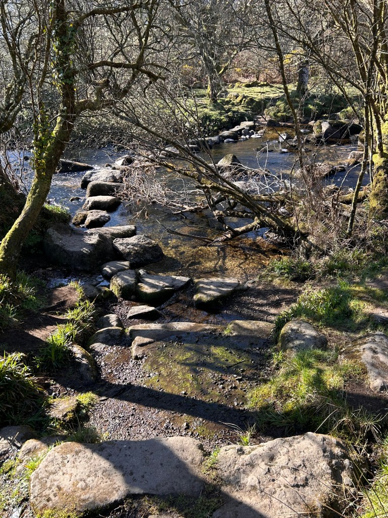
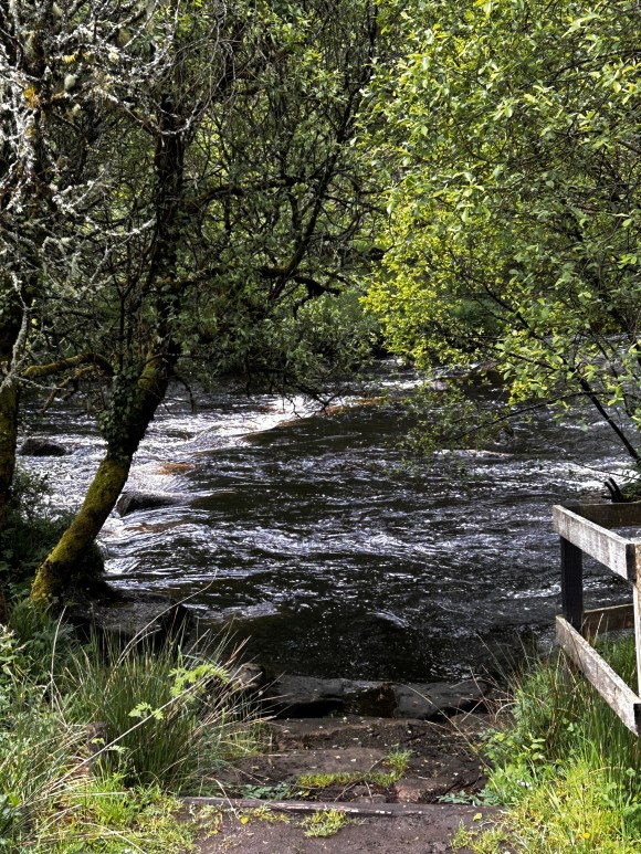
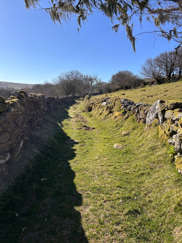
Once across the river, hopefully with dry feet, follow the path threading its way through lichen covered boulders. After emerging from the wood, we continue uphill across fields to reach Combestone Farm, at 670725, where we turn left. Now we follow a lovely green lane that contours round the moor, catching glimpses of Combestone Tor (visited later in the walk) high above us to the right.
After dropping into a shallow valley and crossing a stream, at 675718, our path immediately splits in two and we take the right hand branch climbing out of the valley.
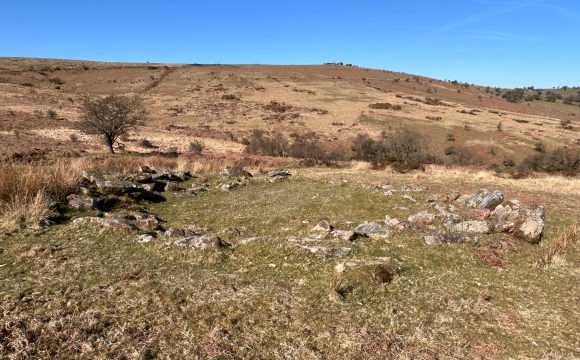
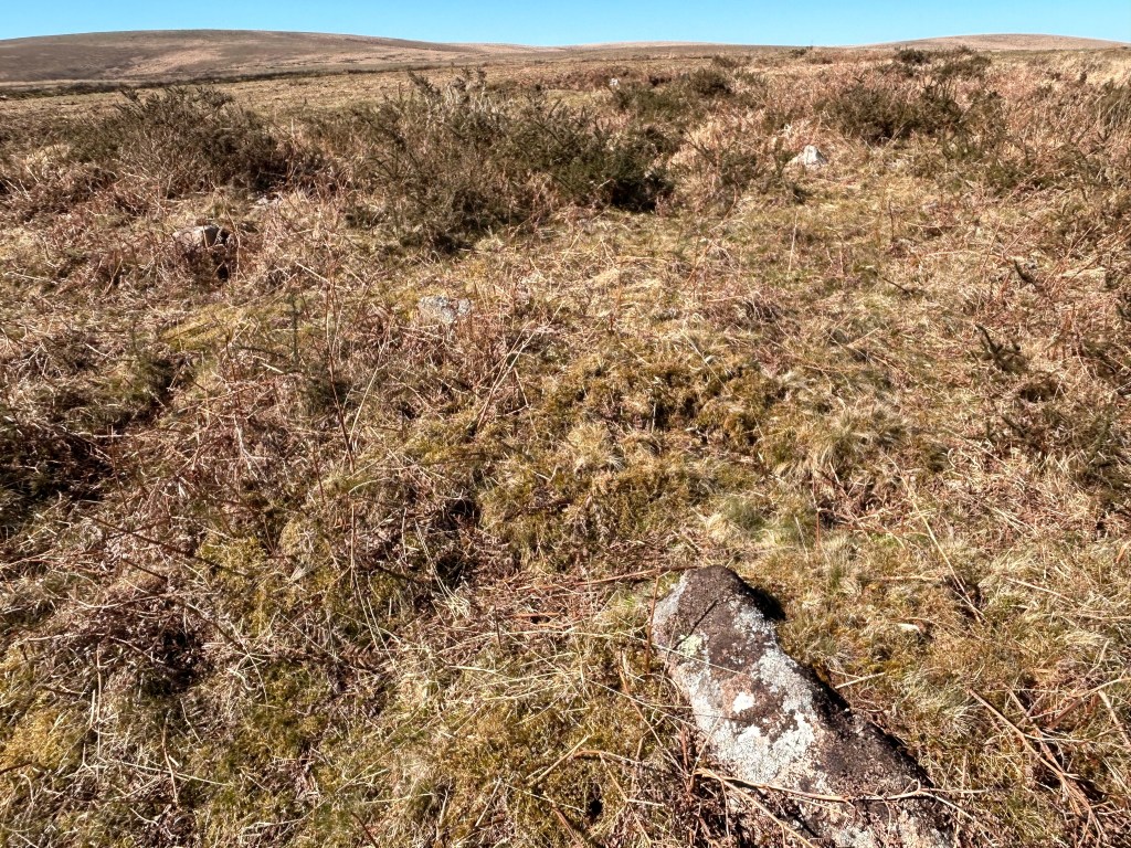
After a short climb we arrive at two hut circles, the more intact circle is just by the path at 676718 with a second, less distinct, one a short walk away in a NNE direction. A Fleming, in “The Dartmoor Reaves” dates the hut circles on Holne Moor from around 1,500BC: as I stand gazing at the same view our ancient ancestors enjoyed into the Dart Valley I find this truly mind blowing.
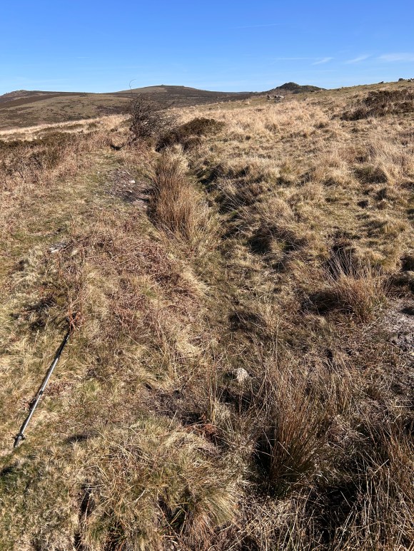
Continue along the path until you reach Holne Moor Leat, at 678716. This leat (also known as Hamlyn’s Leat) originates at the O Brook – which you will visit later – and in the 19th century fed the Hamlyn family woollen mill in Buckfastleigh. Up until 1953, it powered a water wheel at the Buckfast Plating Mill. The leat still runs.
Immediately after crossing the leat leave the main path on a less distinct path to the left and shortly reach another, parallel leat at 679717. Unlike Holne Moor Leat, this one, the Wheal Emma Leat, is dry: it is marked as a black line but not named on the OS 1:25k map.
This leat was built in 1859 to transfer water from the River Swincombe and supplement the flow of water from the River Mardle, a tributary of the Dart, at Wheal Emma and Brookwood copper mines near Buckfastleigh.
The path continues, providing expansive views down the River Dart valley to our left, and taking us past four more hut circles. The first two are found at 681716 close to the path, the third is a little further away off the path to the left at 682716 while a fourth is by the path on the right at 683715. Before reaching the final hut circle we are reacquainted with Wheel Emma Leat at 683715.
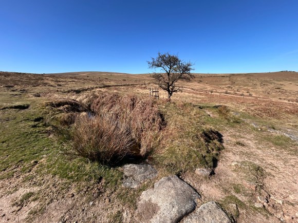
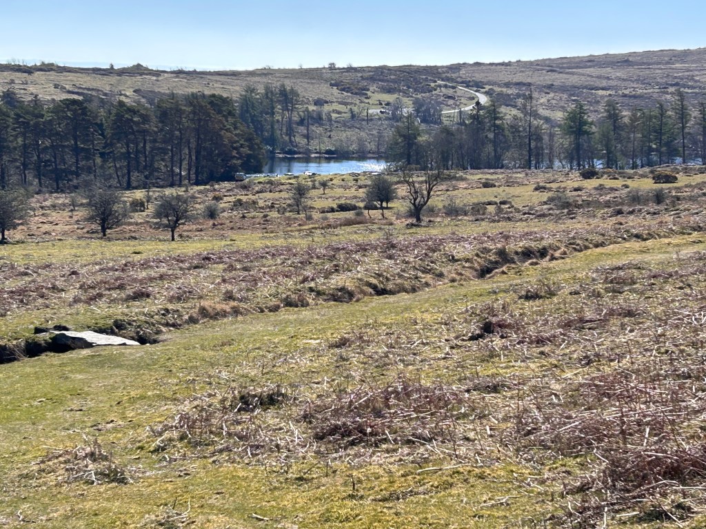
Continuing downhill I heard my first cuckoo of the Spring calling from the woods below Venford Reservoir, which we can now see on our right. We soon cross Holne Moor Leat again and head towards the left end of the woods where we turn right to reach the reservoir: do not be tempted to go by a more direct route towards the reservoir as it can be boggy here, particularly after rain.
At this point I realised I had left my walking pole in one of the hut circles, so retraced my steps until I found it. A “senior moment” some might say, others would call it the careless behaviour of a hapless old fool.
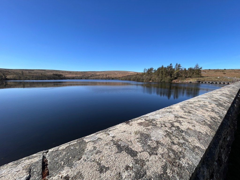
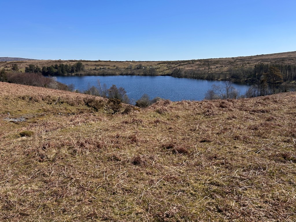
Venford Reservoir, built in 1907 to supply water to Paignton is a peaceful, sheltered spot. A short diversion across the dam or along the waterside path might be rewarded with sightings of some of the wide variety of wildlife residing on the reservoir or in the broadleaf deciduous woodland surrounding it: the rare ring ouzel nests here and brown trout are caught in the reservoir.
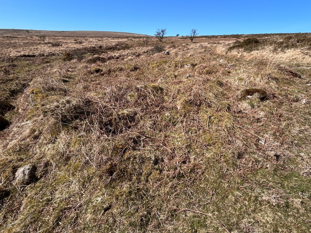
After exploring the reservoir, we head out onto the wild and desolate Holne Moor, home to masses of antiquities and fully justifying its designation as a “Premier Archaeological Landscape”. Leaving the road at 686712 on a path trending south westwards above the reservoir, we pass a couple more hut circles lying near the path at 682710.
Leaving these ancient dwellings, we cross Holne Moor and Wheal Emma Leats yet again and follow the path to a junction at 678706. Here we take a sharp right turn in a northerly direction and at around 677708 leave the path and head over the moor to the right, making for the far end of a triple stone row at 674710.
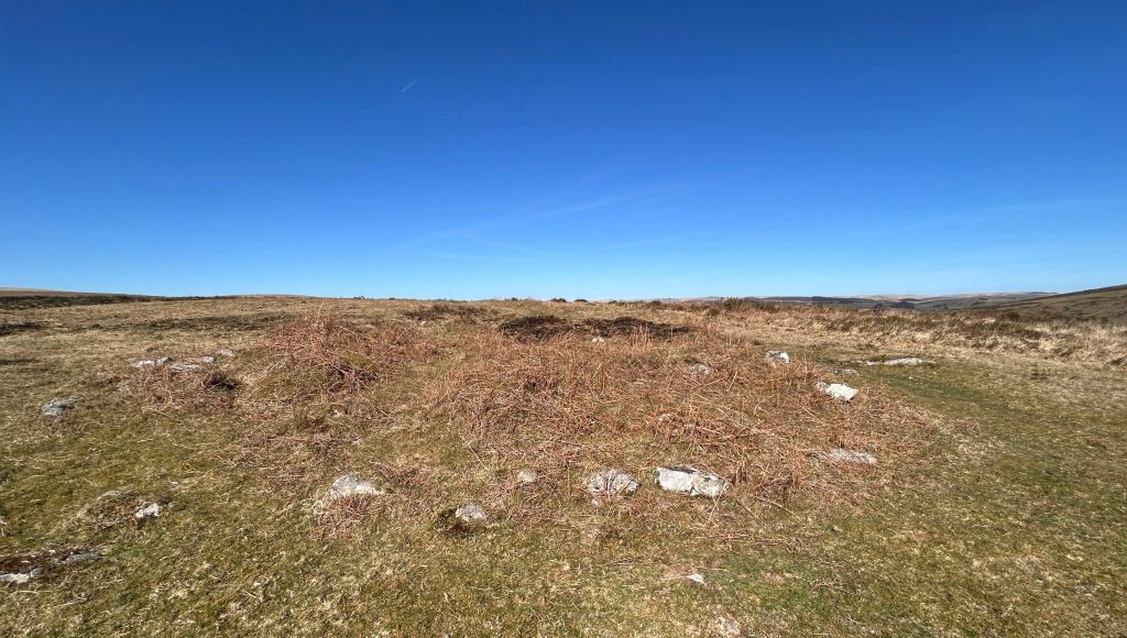
The stone rows are 147 metres long, with the three rows an average of 1.5m apart: however, they do not look as impressive as they sound, most of the stones hardly showing above the peat. We have headed for a fallen 3.4 metre longstone at the western end of the row. Fleming considers the stone row to be an example of the earliest monument type found on the moor and dates it to around 2,500BC. Like I said earlier, truly mind blowing.
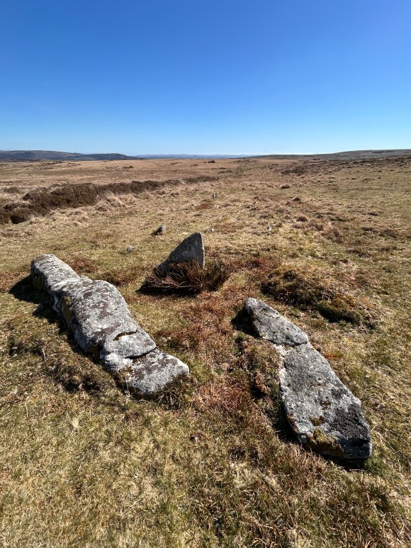
The field boundary parallel to the stone rows forms the southern edge of a substantial bronze age field system. This is the “Holne Moor Reave System” featured in Dartmoor National Park’s “Top Ten Archaeological Sites”. The national park authority’s web-site explains that “reaves” are low, stony banks, now usually covered in turf, which are the remains of bronze age field system boundaries dating from around 1,500BC. We are at the southern end of an extensive pattern of ancient fields extending 5k to the north and forming what is arguably the best preserved of these. After giving a thought to those who lived and worked on the moor so long ago, walk in a westerly direction to regain the path just before Horn’s Cross, now prominent on top of the ridge.
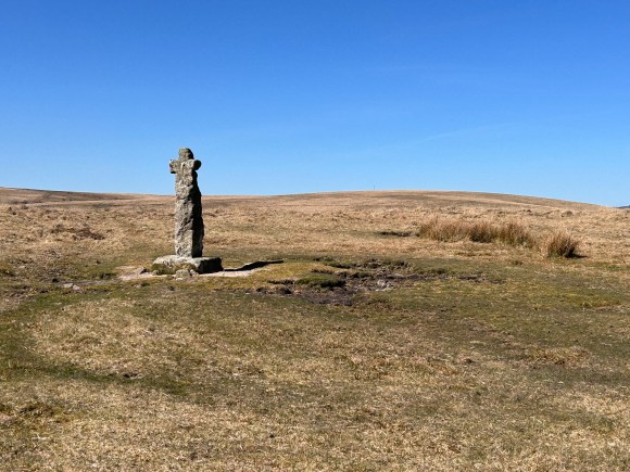
Horn’s Cross (670710) is situated at a place known locally as Stacombe Telling Place – a place where sheep were rounded up and counted (“telling” being counting).
In “The Ancient Stone Crosses of Dartmoor” (1887) William Crossings describes finding the cross in “a sadly mutilated state”. Today, the base and cross are original 14th century but the shaft and iron clamps are recent 20th century replacements.
Horn’s Cross stands at the junction of two ancient pathways. Running north to south is a path between South Brent and Dartmeet, while the path running east to west forms part of the ‘Monks Path’ which linked Buckfast Abbey with those at Tavistock and Buckland.
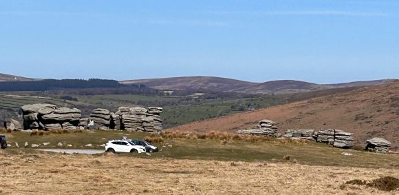
We turn right at Horn’s Cross and head in a northerly direction downhill to Combestone (or Cumston) Tor at 671718. This imposing group of rocks command a breathtaking view of the steep sided, heavily wooded Dart valley and beyond to Sharp Tor on the far side.
You might think this is just another unadorned lump of old granite – but you’d be wrong! Combestone Tor is the site of an OS benchmark cut into the south face of the tor that is used to register a recorded height of 1156.6ft and other items of interest include rock basins that have formed over millennia on the top slabs, some of which have now slipped from the horizontal.
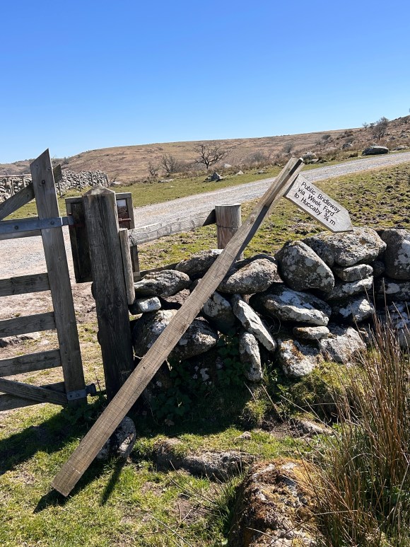
Starting our descent to Dartmeet from the tor, we head in a north-westerly direction to join a farm track running downhill from the road. After going through a gate at 669722, we turn left off the track onto a path, sign-posted to Huccaby. The sign post was lying down when I was there, but it looked like a new one awaiting erection rather than evidence of weathering or vandalism. The path takes us into the valley to cross the West Dart River by Week Ford.
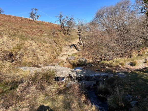
Just before reaching Week Ford we cross O Brook, which feeds Holne Moor Leat which we have crossed three times: a huge amount of industrial activity took place up this valley in the past and the area is notable for its historic tin mines and associated artifacts, such as blowing houses, moulds, mortars and mill stones.
According to George Thurlow’s “Dartmoor Companion”, tin has been extracted from the moor since the late 12th century: here we can divert from our path to visit a fine example of this industry, the O Brook blowing house at 662723). In her excellent “Dartmoor Tors Compendium”, Josephine M Collingwood tells us that such mills date back to between medieval times and the 16th century.
Two buildings are found here – the lower one is Beare House, the upper one is the mill. There is a deep wheel pit in the house. In the mill smelting took place to extract metal from ore in a furnace and was cast into ingots in moulds that resembled small bread tins. A mould stone and numerous mortar stones, used for crushing the tin ore before smelting, can be seen. If time allows, a short walk up to the higher reaches of O Brook reveals extensive mounds of tinners’ debris.
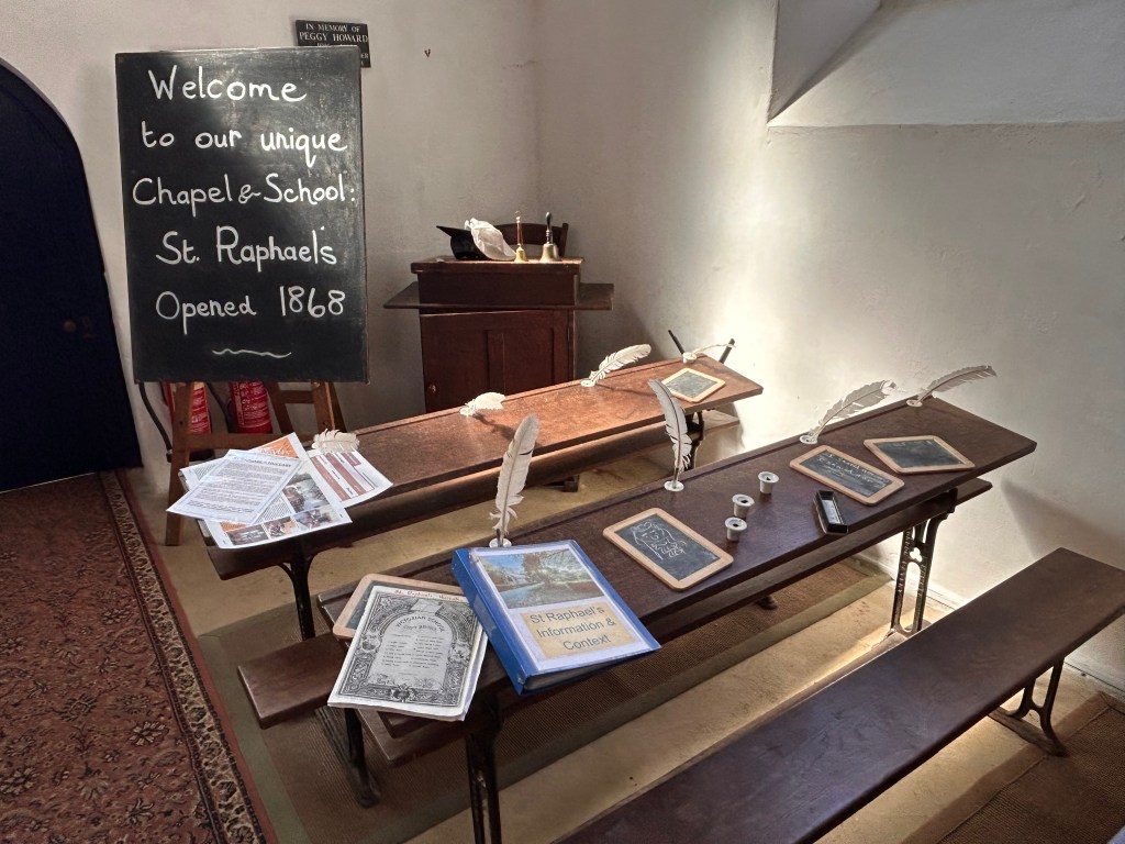
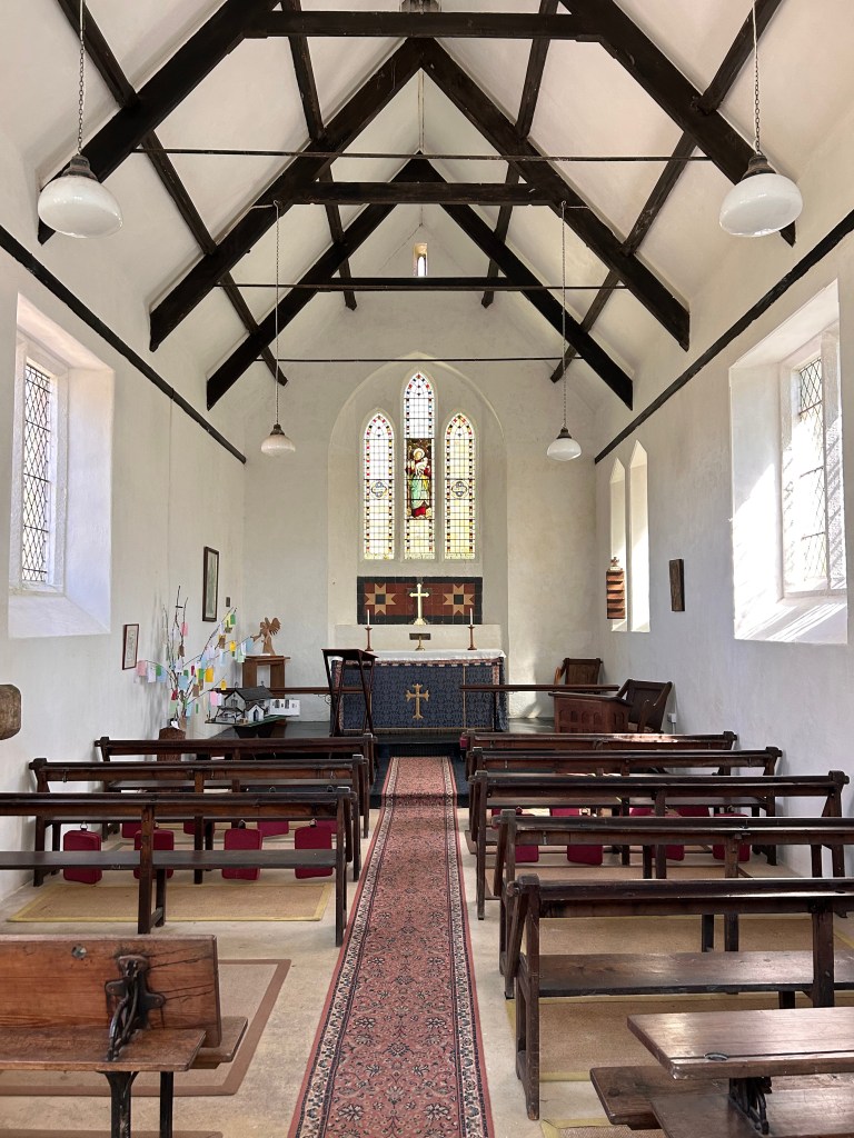
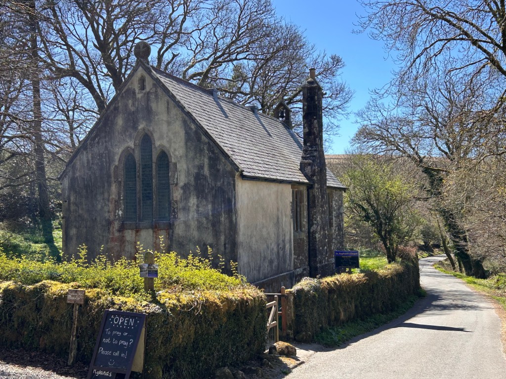
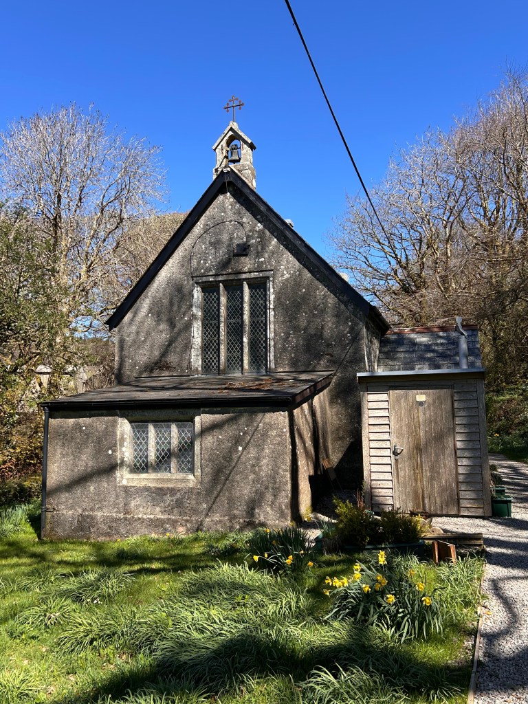
After reflecting on how tough the miners must have been to eke out a living labouring in such a harsh environment, we cross the West Dart River on the attractive stepping stones at Week Ford (662724) and continue upwards until we leave the path near Huccaby Farm and double back to our left to visit St Raphael’s Chapel at 663730.
The delightful chapel and schoolroom was built in 1868 on the site of ruined thatched cottages and is the only Anglican chapel dedicated to the Archangel St Raphael, a patron saint of travellers. Before the chapel was built worshippers and schoolchildren had to go to Lydford to pray and be educated. Noteworthy features are the scholars’ desks, which doubled as pews on a Sunday and the ‘Good Shepherd Window’ behind the altar, donated in 1888 by the Adams family of Huccaby in memory of Edward, who died aged 11.
The chapel is open every day and if you go in Springtime you might be lucky enough to see a spectacular display of snowdrops, which have been captured in an uplifting YouTube video.
We return to the path and follow it to the left of the farm and over a hill into the valley, where we eventually pass to the left of the stepping stones we crossed at the start and up to the road taking us back to the car park.
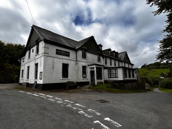
Spiritually refreshed after our visit to the chapel, thoughts may now turn to more earthy refreshment. If so, you could do worse than turn right out of the car park over the bridge and take the next turning on the left to reach the Forest Inn, in the attractive rural hamlet of Hexworthy. This traditional Dartmoor coaching inn reputedly dates back to the late 17th century and serves good beer and reasonably priced food in a comfortable and characterful bar.
SOURCES
In researching these posts I have relied heavily on a number of excellent publications. I would recommend all of them to anyone interested in delving deeper into the wonderful world of Dartmoor;
- George Thurlow: Thurlow’s Dartmoor Companion (written by a national park guide, this beautifully illustrated book “describes the different aspects of the moor, from geographical features and wildlife to prehistoric sites and industrial archaeology”)
- Helen Harris: The Industrial Archaeology of Dartmoor (a definitive and user-friendly guide)
- Eric Hemery: Walking Dartmoor’s Ancient Tracks (a definitive guide to the history and routes of ancient trackways – and much else along the way)
- John Hayward: Dartmoor 365 (a true labour of love, this book divides Dartmoor into its original 365 square miles and provides walks and at least one item of interest in each of them. A delight.)
- Samuel Rowse: A Perambulation of Dartmoor (first published in 1848 and revised since, this is one of the definitive works on Dartmoor and its prehistory. It is also a fascinating insight into how the moor and its attractions were perceived in those far-off times)
- Josephine M Collingwood: Dartmoor Tors Compendium (an incredibly accessible glossary of 155 tors and places of interest surrounding them)
- Stephen H Woods: Dartmoor Stone (wonderful photographs illustrate “the evidences of man in his moorland environment”.)
The following websites have also proved invaluable in writing my blog;
- Tors of Dartmoor. The definitive list of lesser and well-known tors.
- Legendary Dartmoor. A wealth of fascinating stories.
- The megalithic portal. A data base of ancient sites throughout Europe.
- Prehistoric Dartmoor Walks. Does what it says on the site!
DISCLAIMER
I can take no responsibility for any loss or injury caused by following the above walk. The description is an accurate outline of the route and should enable you to follow the walk on an OS map, but the walk should not be attempted without a map, compass and the ability to use them!
Discover more from Over the hill - on Dartmoor & in Lakeland. I
Subscribe to get the latest posts sent to your email.
