Disappointment at Dartmeet
(or, in praise of aimless wandering).
Making the best of it and being rewarded with new tors and fine views.
In this series of Dartmoor “Over The Hill Hikes” (OTHHs) I intended to record rambles suitable for those of a certain age (i.e. walkers like me: past their hillwalking peak but still able to just about put one foot in front of the other) that reflect my fascination with churches, antiquities, industrial archaeology….. and pubs. This short blog reports an outing that didn’t quite go according to plan.
I arrived at Dartmeet on a damp, grey, unseasonably cold May morning and met up with my old friend Roger. We aimed to complete a circular walk taking in St Raphael’s church at Huccaby, Combestone Tor, a couple of leats and a variety of places of historical interest.
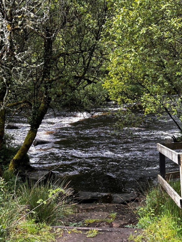
This was our second shot at this walk, having had to abort an attempt a few months earlier a few hundred yards from the car park after finding the stepping stones across the West Dart were submerged. After a sustained period of dry weather, we felt more confident of a safe passage this time: however, heavy rain on the previous couple of days did raise a residual doubt.
Filled with optimism (not my default position, to be honest), we set off, but again found that the stepping stones were underwater. Although wild swimming is increasingly fashionable on the moor, we decided to give it a miss and went back to the car park to consider our options.
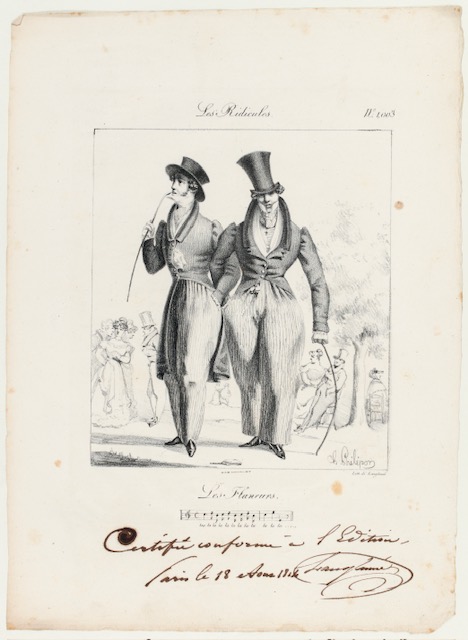
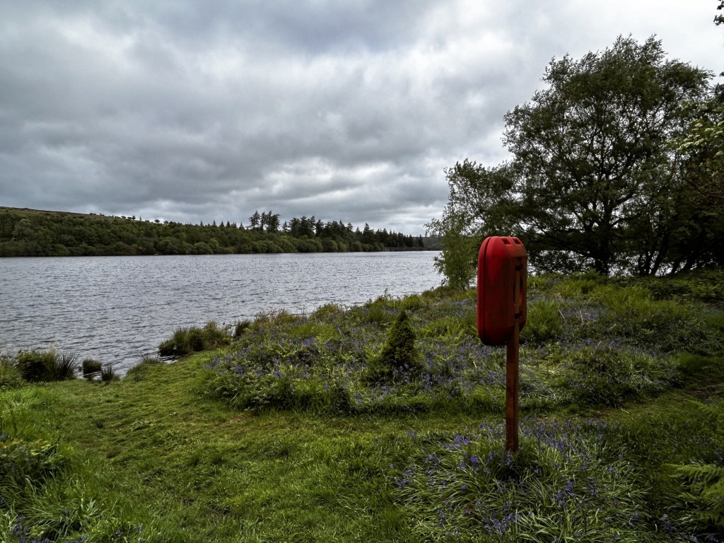
Abandoning a walk is not the worst thing that can happen to you, but we still felt pretty frustrated and fed up. In view of the inclement weather and the fact that neither of us really felt 100%, we decided to drive the short distance to Venford Reservoir with a vague notion of wandering around the reservoir and maybe exploring unfamiliar territory to the east before calling in the Forest Inn, Hexworthy for lunch. We decided against making a rigid plan and walked aimlessly where our fancy took us, rather like a moorland version of French urban strollers, or flaneurs. There follows an account of what proved to be an unexpectedly enjoyable walk.
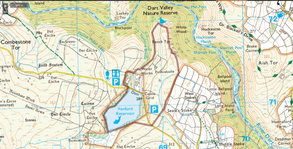
| Start/Finish | Venford reservoir car park (SX686712) |
| Distance | 2.5 miles, but felt further |
| Terrain | Easy going, on good paths. There is a proliferation of paths hereabouts, but few are marked on the map. |
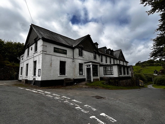
| Pub | Forest Inn, Hexworthy (SX 655726) |
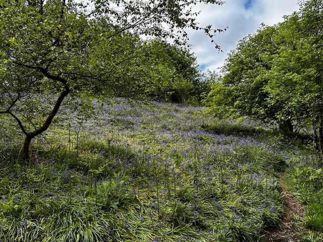
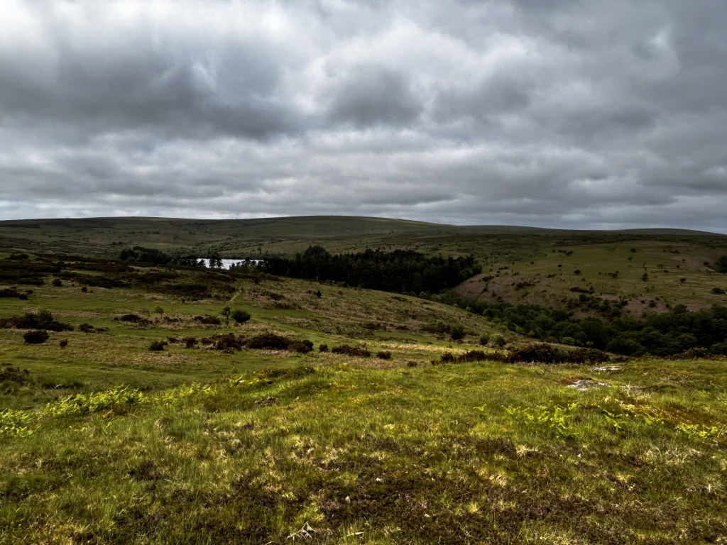
Making it up as we went along, we sauntered round the deserted reservoir, accompanied by an enchanting chorus of bird song and passing an attractive patch of surprisingly late bluebells.
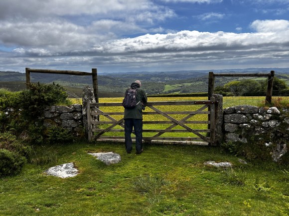
Despite having walked on Holne Moor many times, neither of us had explored the area to the north east of the reservoir, so we struck off in that direction. After crossing a road we made our way to Bench Tor on one of the many paths that criss-cross this part of the moor: our path following the wall between open access land and the closed field systems leading south eastwards towards Holne. Looking in that direction gave us an expansive pastoral view, which Roger is here seen admiring.
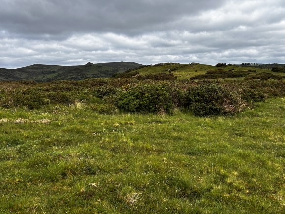
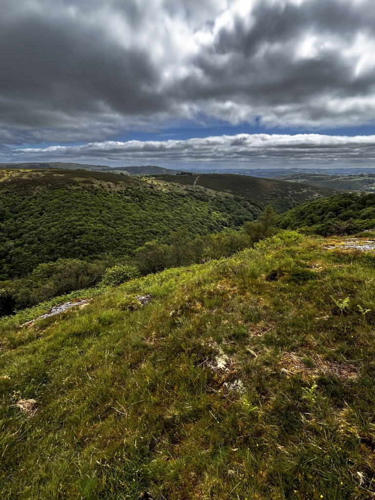
Bench Tor, which we’d never visited, stands atop a distinct promontory high above the River Dart. It comprises an impressive cluster of granite outcrops, with its most prominent, “North Tor”, offering superb views into the heavily wooded Dart valley far below and back towards Venford Reservoir.
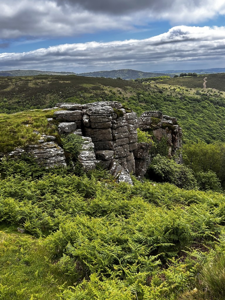
The tor is named Bench Tor on current OS maps, but the group of rocks it contains have gone by a variety of names over the years. In his seminal “Guide to Dartmoor” (1912) William Crossing observes that the tor “consists of several piles, two of them being named in an old deed North Bench Tor and South Bench Tor respectively ……. another is known as the Eagle Rock”. But Bench Tor isn’t the only name to have been given to these rocks: in his “High Dartmoor” (1983) Eric Hemery prefers the name Benjy Tor, explaining that it was “rendered as Benjay Tor on the first edition of the OS one inch map of 1896”. To further confuse us, the 19th century Tithe Map names the North and South tors as North Benchator and South Benchator respectively.
I am indebted to the invaluable “Tors of Dartmoor” website for details of the fascinating evolution of the tor’s name. I would strongly recommend this searchable database, which provides the most definitive list available of both lesser and well-known tors and rocks.
I was not surprised to learn, from Josephine M Collingwood’s “Dartmoor Tors Compendium”, that the rocks here are frequented by rock climbers and contain more than 28 routes graded from “Difficult” up to “Extremely Severe” (or to those climbers who aren’t living in the distant past like me, up to a grading of E66b). According to Collingwood, rock climbing began on the moor in the late 19th century, but routes only started to be recorded in 1935.
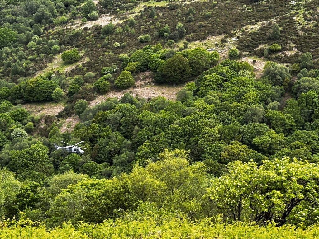
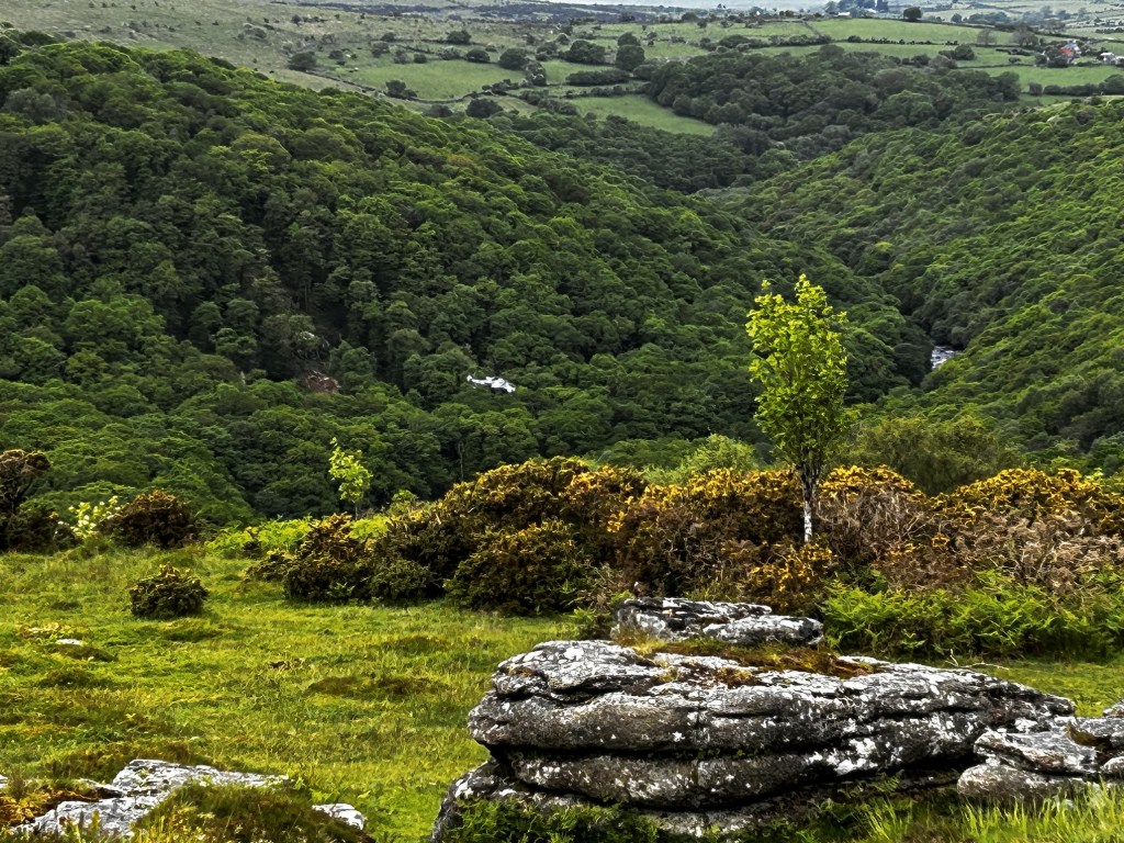
After marvelling at the low-flying skills of the helicopter pilot, possibly on his way home to the Royal Marine camp at Lympstone from the training areas on the north moor, we continued to the end of the Bench Tor ridge and turned in a south westerly direction towards the valley of Venford Brook.
Before reaching the valley floor the path bears left to traverse the moorside, leading towards the water works by the reservoir. Unlike the West Dart earlier, the brook was fordable just before the water works and a decent path took us back to the car park.
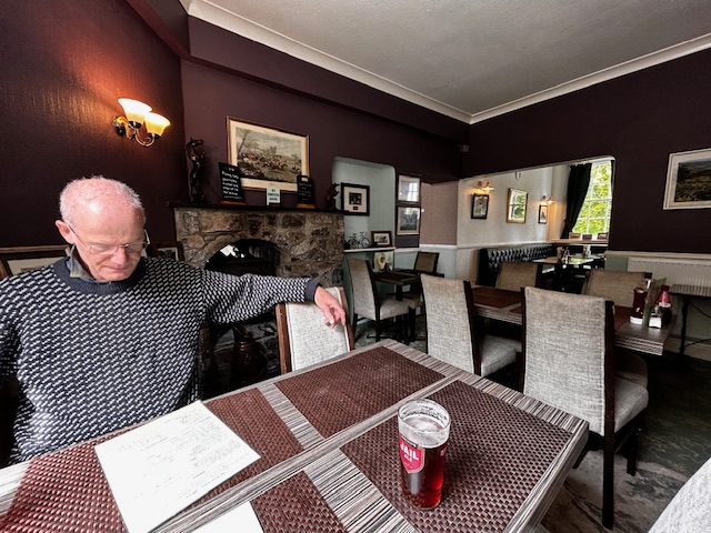
So, after a disappointing start, our ad-libbed ramble was most enjoyable, providing a pleasant nature walk round a peaceful reservoir, fine views and a nice pint at the Forest Inn.
If there is a lesson to be learnt from our experience it’s that on the hills – as in life generally – if your plans are confounded don’t despair. Try a little “aimless wandering” and you never know where it might lead you.
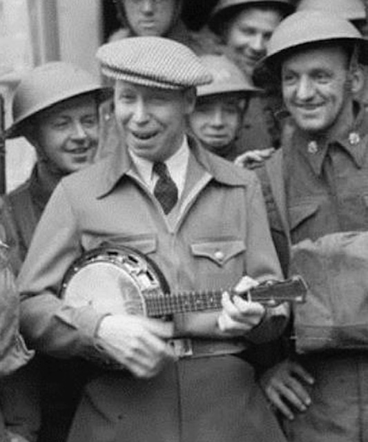
Or, in the words of the great Lancashire film star, singer and wizard of the banjolele, George Formby, you’ll hopefully find that things “turned out nice again”.
SOURCES
The principal sources consulted in researching this series of Dartmoor OTHHs are set out in the introductory blog.
DISCLAIMER
I can take no responsibility for any loss or injury caused by following the above walk. The description is an accurate outline of the route and should enable you to follow the walk on an OS map, but the walk should not be attempted without a map, compass and the ability to use them!
Discover more from Over the hill - on Dartmoor & in Lakeland. I
Subscribe to get the latest posts sent to your email.
