“Over The Hill Hikes” (OTHHs) are designed for the older walker, like me and reflect three of my passions – churches, pubs and reminders of Dartmoor’s rich history. More on these themes can be found here.
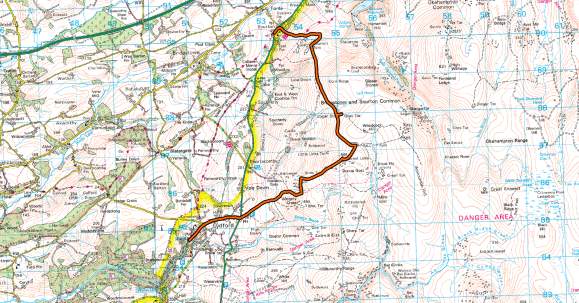
This second Dartmoor OTHH takes you on a journey along the wild western edge of the national park.
| WALK | A linear ramble along the western edge of Dartmoor, from Sourton to Lydford. |
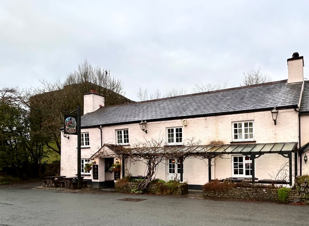
| START / FINISH | Park in the free car park opposite the Castle Inn, Lydford (510857) and catch the (hourly) bus to Sourton, from where the walk begins. |
| DISTANCE | 6.7m |
| ASCENT | 1,264ft |
| TERRAIN | Mainly good paths and old railway tracks, but it may be soft underfoot while traversing Sourton Tor and Great Links Tor. |
| PUB | The Castle Inn, Lydford is a nice cosy place to end the walk. You will also pass the quirky Highwayman’s Inn at Sourton, where, if it’s open, you could enjoy a pre-walk morning coffee. |
SOURTON – GETTING CROSS WITH GHOSTS AND GOULIES
Leaving the car park at Lydford, cross the road to catch a bus outside the Castle Inn for the 13-minute ride to Sourton (this is the Okehampton bus). Don’t worry though as you’ll be able to explore this fascinating ancient village (and its pub) on your return.
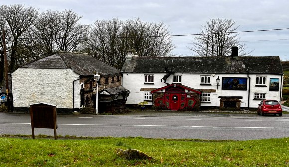
Get off the bus in Sourton just short of the Highwayman’s Inn. Walk along the A386 to the inn and pause for a look at one of Devon’s oddest pubs.
There has been an inn here since the 13th century: originally called the New Inn it was extended in 1812 and re-named The Highwayman’s by new owners in 1959. Since then, it’s been transformed into a place tourists flock to, attracted by its reputation as the most unusual and most haunted pub in Britain.
From the minute you enter, through an old stage coach installed in the doorway, you are overwhelmed by the weird and wonderful curios and assorted nick-nacks assembled here. These include a statue of Tutankhamun, a 6ft minotaur and a bar decked out as a galleon, using parts from an old shipwrecked whaler. There have been many alleged sightings of ghosts here, including shipwrecked mariners and a man dressed in green with a feather in his hat.
I have visited the Highwayman’s before, but it was closed when we walked past on an overcast, damp morning in February. I was not too sad though, as I prefer my pubs a bit more traditional and less gimmicky and knew that an inn meeting both these requirements awaited us in Lydford. If it happens to be open though, it’s definitely worth a look in the Highwayman’s, as I doubt you’ll have seen anything like it.
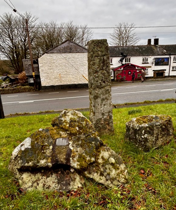
The inn isn’t the only interesting thing to see in Sourton. The village developed in the 19th century to support farming and related trades, including lime production, but opposite the inn, on Sourton Green, there is evidence of much earlier settlement. The stone pillar you see here is the shaft of an early Christian Saxon cross. It has “O”s and “X”s engraved on two of its faces, hence its alternative name, “The Oxo Stone”. The granite pillar was erected here in 1985, having been discovered holding up the roof of a shed in a nearby farm.
Leave Sourton by a track climbing gradually uphill from the village green. This path is shared by both the Dartmoor Way and Two Castles Way. The Dartmoor Way, which we encountered on our previous walk, is an 84 mile long footpath circumnavigating the moor and passing through several towns and villages around its border: the Two Castles Trail is a 24-mile walk linking Okehampton and Launceston Castles. The route coincides with the West Devon Way at the eastern end and links with the Tamar Valley Discovery Trail at Launceston in the west. The three routes can be combined as a 100-mile circuit around western Devon.
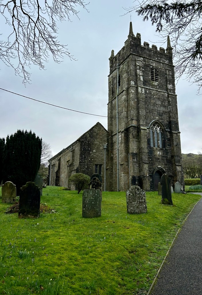
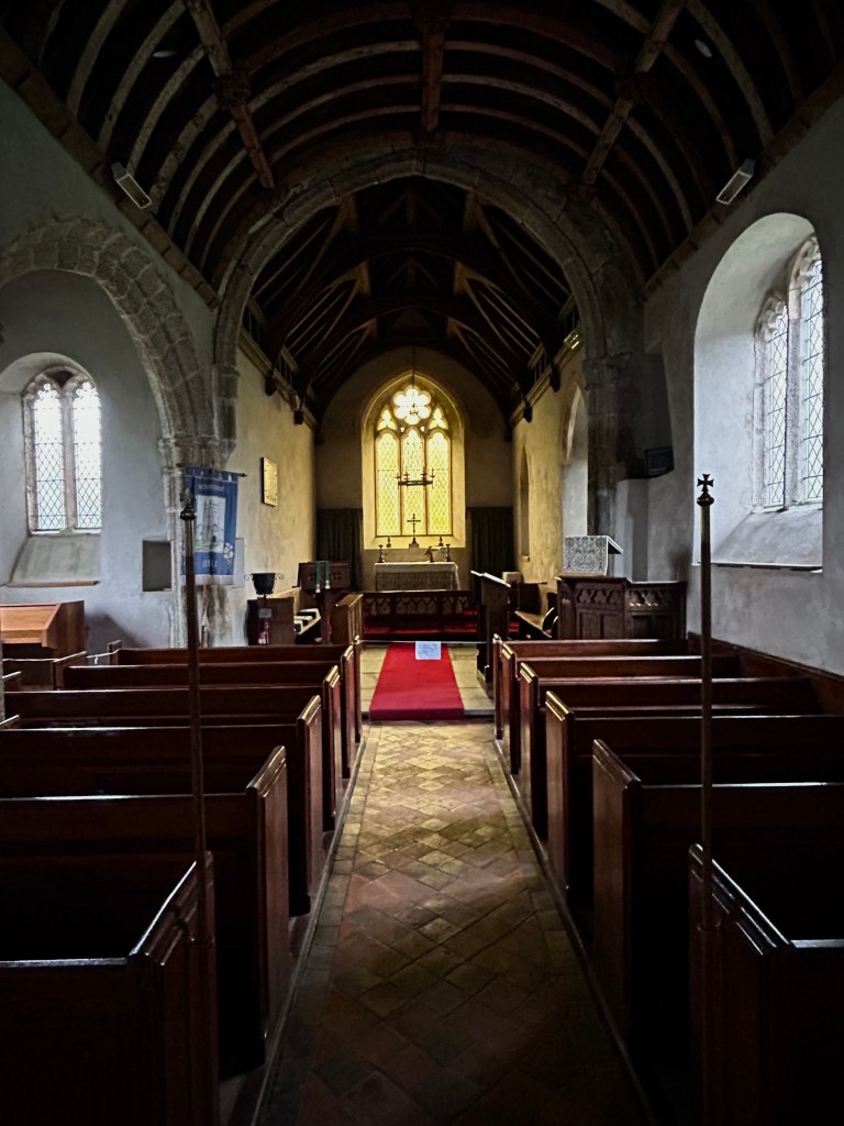
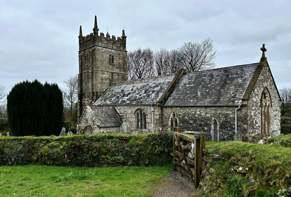
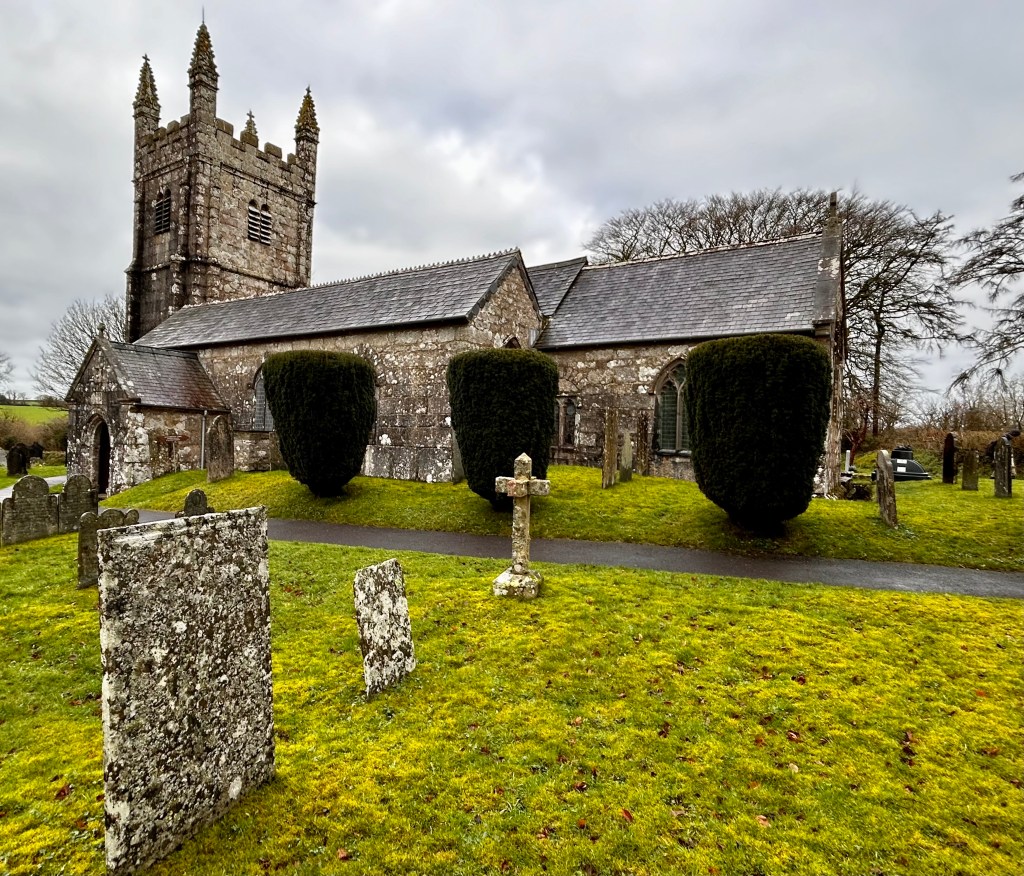
Shortly after passing the village hall, we reach Sourton’s final attraction, St Thomas a Becket church. This church was founded in the 14th century on the site of an earlier settlement thought to date back before 970, when a simpler building was on the site. It was dedicated as St Thomas a Becket by the descendants of two Devon Knights who had taken part in the murder of Thomas, Archbishop of Canterbury in 1170. It seems their successors wanted to clear their families’ names and salve their consciences by re-dedicating the church to the Christian martyr.
The interior is light and airy, with a recently donated stained-glass panel, made up of mainly Victorian glass from Canterbury. Another interesting feature is a wooden panel in the north wall bearing Charles II’s coat of arms. This is a reminder to the people to remain loyal to the crown after their involvement on the parliamentarian side in the 1643 civil war, when the battle of Sourton Down was fought.
It’s a peaceful place in a wonderfully wild location, offering expansive views from a churchyard strewn with slate gravestones. Its ambience was summed up by Rev A Hunter, vicar here from 1953-63;
“A moorside church, to Tors akin, grey without and calm within”
SOURTON TORS – ICE WORK IF YOU CAN GET IT.
After leaving the church continue uphill crossing over the Granite Way, a cycle trail from Okehampton to Lydford that for much of its way follows the route of the long-disused London and South Western Railway track, part of the Exeter to Plymouth route completed in 1876.
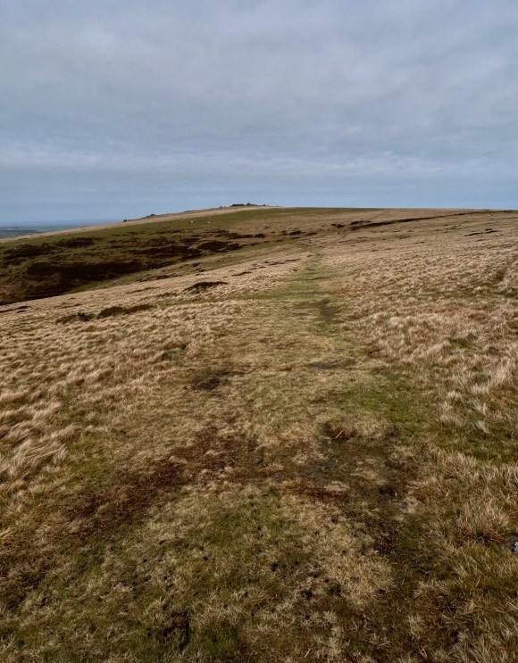
The path steepens as it ascends towards Sourton Tors and we leave the two “Ways” as they turn left at 541901 and continue upward and ahead to round the northern end of the ridge on which the tors sit.
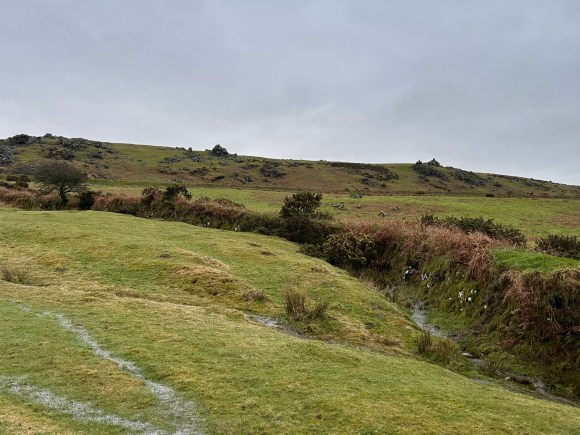
As we turn southwards (546901) to walk along the broad ridge to Sourton Tors, we pass another interesting feature, the ‘Ice Factory’. A 10ft square depression, once an ice pond, and the remains of an old wall are all that’s now left of a Victorian project that, from 1875, supplied ice to meet the demands of fishermen, fishmongers and domestic customers in both Plymouth and Exeter.
This site was chosen because of the plentiful supply of water and the icy winter temperatures at this exposed spot. After it froze, the ice was stored underground before being taken to Plymouth from Bridestowe on the South Western Railway line. The fortunes of the business were adversely affected by the incidence of mild winter temperatures and after many ups and downs the enterprise finally folded in 1886.
After reflecting on the backbreakingly hard labour that must have been involved in managing the ice and transporting it to Bridestowe, continue to Sourton Tors.
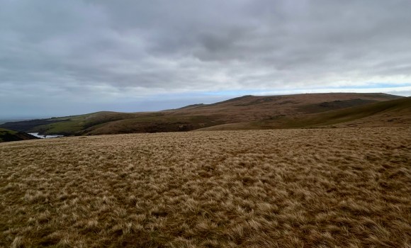
The tors are a collection of volcanic rock outcrops, rather than the prevalent granite and provide wonderful views towards Cornwall’s Bodmin moor to the west and High Wilhays, the highest point on Dartmoor ( and indeed the whole of southern England) to the east.

FOR PEATS SAKE, LET THE TRAIN TAKE THE STRAIN.
From the tors, walk downhill to cross the valley bottom at 545895, marked BS, (“boundary stone”), on the OS map.
Continue uphill on a good path to meet a track running left to right at 545891. Cross the track and take a minor path in a south easterly direction to reach a clearing with a good track running into it from the other side (546887). This track was the Rattlebrook Peat Railway and the clearing is the reversing point where wagons were run in and stopped for the points to be changed and the horses moved to what had been the rear of the wagon before continuing.
The standard gauge peat railway was completed in 1879 to service the Rattlebrook Peat Works (559872). The works owners, the West of England Compressed Peat Company had been given their first license by the Duchy of Cornwall in 1878, although peat extraction had taken place since the 1850’s. The railway track descended 1,000ft in 5 miles on its way to connect with the London and South Western Railway at Bridestowe.
The extraction of peat continued intermittently, latterly under different owners, for over a century. Specially adapted petrol driven locomotives were introduced for a short period in the early 20th century, but eventually the line proved too expensive to operate and was discontinued in 1932. Even then, the enterprise limped on but finally closed in the 1950’s.
As at other disused industrial sites on the moor, I marvel at how this now remote, wild, scene was once a hive of activity and reflect on how tough the workers must have been to make a living labouring in such an inhospitable working environment.
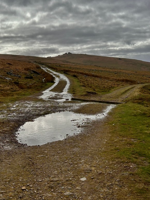
Continue walking along the old railway track with Great Links Tor looming ahead. We were intrigued by a “logan stone” shown on the OS map at Gren Tor, which lies to the left further down the track (551879). Like us you might choose to leave the track when it passes nearest to the tor on one of the paths that head leftwards. “Logan”, or rocking stones are large stones so finely balanced that just a small amount of force causes them to rock. We could find no trace of one on Gren Tor and I’ve found no reference to anyone else who has: but we did find shelter for a sandwich and enjoyed the fine all round views from the tor, including the south west vista towards Great Nodden, which according to Crossings in his “Guide to Dartmoor” is also known as “plum pudding hill”.
By now the sky had started to brighten and the views became more expansive as we neared Great Links Tor, but the icy wind blowing in from the west would have been enough to keep the ice works in business for weeks. We ignored a path that leaves the railway track on the right for Great Links, as it looked rather steep for two old codgers and proceeded along the track until we reached the end of a ridge at 555871, where we turned right to leave the track, on a path that is at first ill-defined but becomes distinct as it leads up to Great Links Tor.
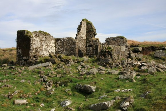
At this point you could delay your ascent of Great Links Tor and continue along the railway track to visit “Bleak House” (560865), just below Green Tor: this dilapidated ruin has nothing to do with Dickens but is all that remains of a house built for the manager of the peat works. Originally called Dinnaford Cottage, it only gained its present name after becoming derelict.
GREAT LINKS TOR, ANOTHER CROSS AND A (RIVER) CROSSING
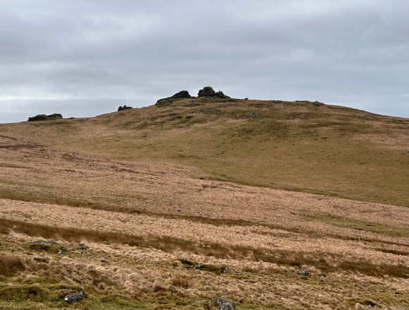
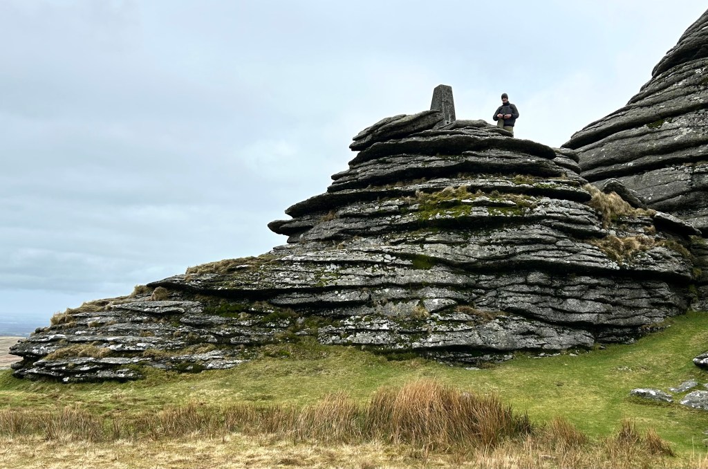
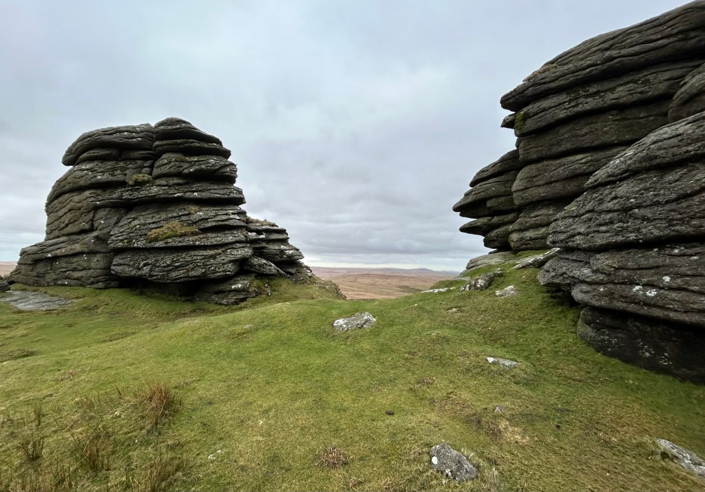
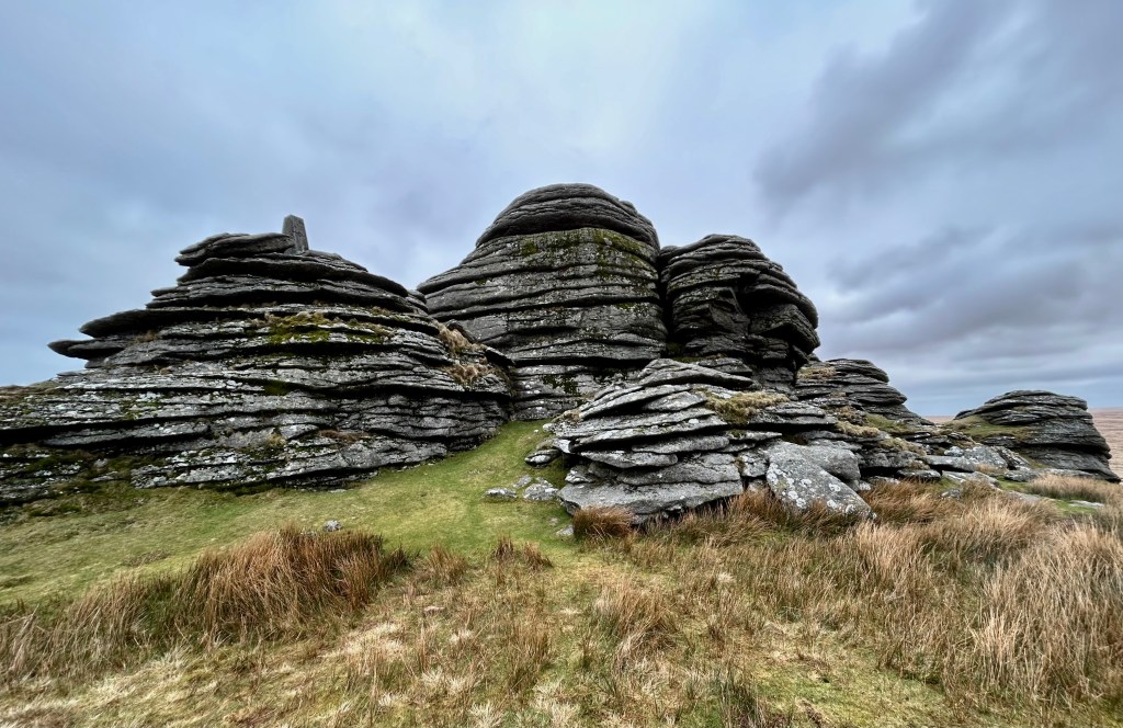
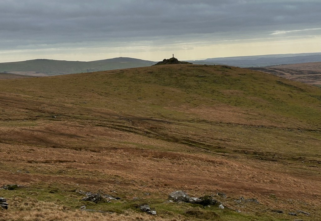
Back on the ridge, we soon reach Great Links Tor, undoubtedly the highlight of the walk: the views of neighbouring tors and over the border to Bodmin Moor being spectacular. In her beautifully illustrated and highly informative “Dartmoor Tors Compendium”, Josephine M Collingwood describes it as “one of the best tors on Dartmoor” and if you were stood where we were drinking in the view (and the hot Vimto) and marvelling at the several huge, horizontally stratified, granite monoliths you wouldn’t disagree.
After another sandwich and a drink in a sheltered rocky nook, we descended towards Arms Tor (540863) then struck off to the left across a shallow valley to join the Mary Michael Pilgrim Way, which we trod on our previous walk, on a better path below Widgery Cross. The cross (539856) on Bray Tor was erected by William Widgery to commemorate Queen Victoria’s Golden Jubillee in 1887 and is worth a visit if you’ve not had enough spectacular views for one day.
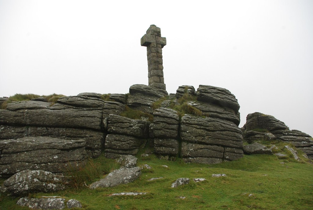
(close-up, “Widgery Cross atop Brat Tor by Tim Hardy)
Follow the path down to cross the river Lyde by a ford or bridge at 532857 and proceed on a good track to cross the A 386 and then along a minor road to Lydford.
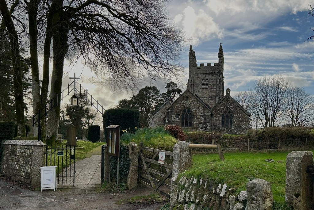
THE DELIGHTS OF LYDFORD
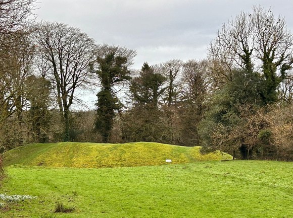
If you need a reminder of what an ancient village Lydford is, you’ll get it as you walk past the charming village hall, where you’ll see Saxon defence mounds on both sides of the road.
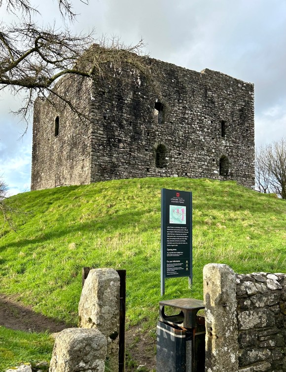
Lydford was once a very important town. A settlement was established here by King Alfred the Great and it first appears in recorded history in 997AD, when the Danes made a plundering expedition up the Tamar and Tavy as far as Lydford. During Ethelred the Unready’s reign there was a mint here and the town became very prosperous. A prosperity that was never fully recovered under the Normans.
A most striking feature of the village is its castle. The first castle on this site dates from circa 1066, its replacement was established in 1132 and it was first mentioned in dispatches in 1216. It became an infamous prison and a meeting place of the Forest Court of Dartmoor and was described by a 1512 act of Parliament as “one of the most heinous, contagious, and detestable places in the realm”. One of the seats of the bloody assizes of Hanging Judge Jeffries, its reputation was attested to by local Tavistock poet, William Brown who in the 17th century commemorated the prison in his “Lydford Law”.
“I’ve often heard of Lydford law,
How in the morn they hang and draw,
And sit in judgement after”.
Despite plenty of competition, the main draw of Lydford for me is St Petroc’s Church. The church marks the end of the Lych Way, a 12-mile hike from Belever along an old coffin route: until the 12th century parishioners from most of Dartmoor were brought to Lydford for burial. There have been many alleged sightings of fantom coffin parties on the route, but I’ve walked it a few times and the only spirits I’ve seen have been in the pub afterwards.
St Petroc – an itinerant monk who preached throughout the West Country in the 6th century – was said to have sheltered where the church now stands. The Norman church we see today was founded on an earlier settlement where it is thought a small timber church, probably built circa 650, stood before being burnt down in 997 by the Danish raiders mentioned earlier. The church was enlarged in the 13th century, with a tower and aisle being added in the 15th.
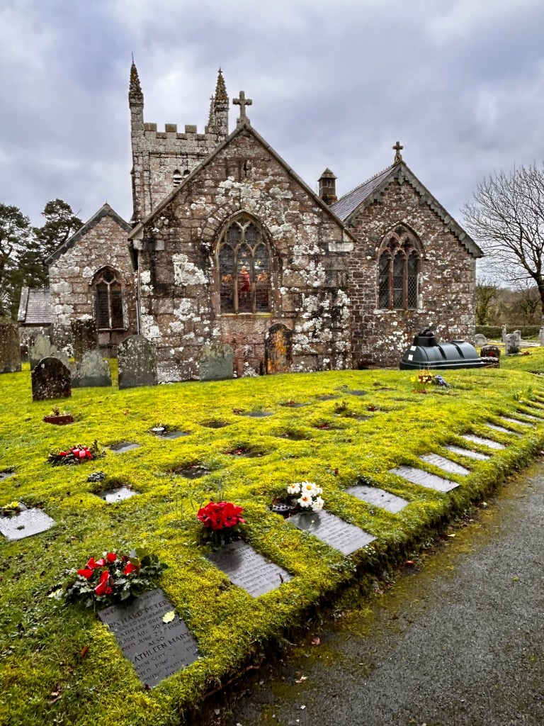
The interior, with its Saxon or early Norman font and pews with attractively carved bench ends is well worth a visit.
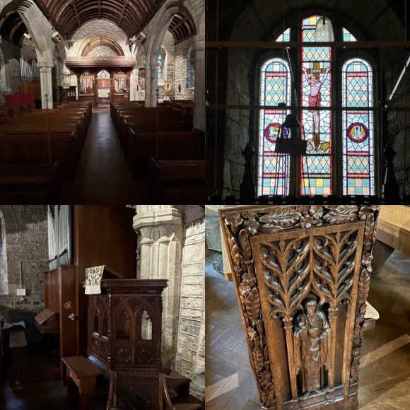
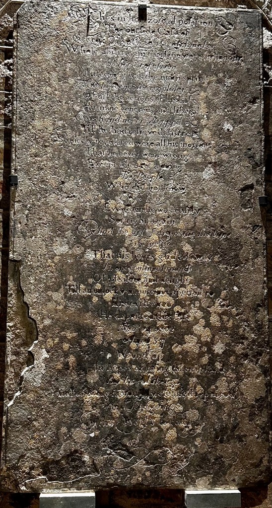
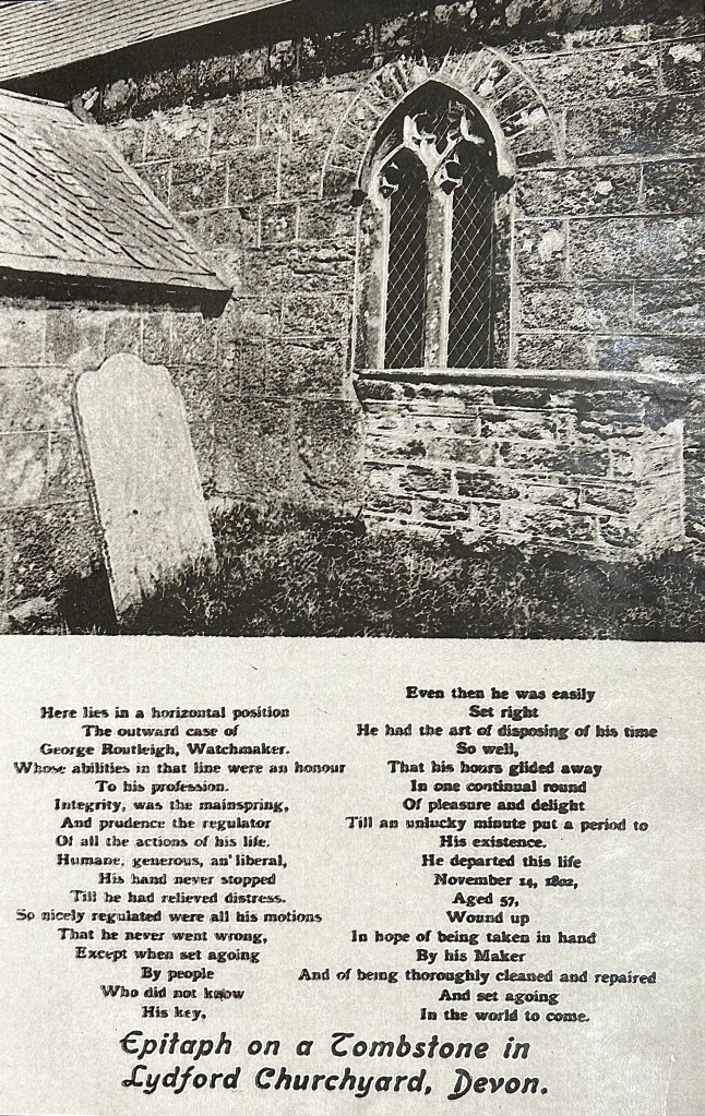
An amusing feature of the church is a tablet on what was once on a watchmaker’s tomb in the churchyard, but is now safely installed inside. The tablet bears a unique epitaph describing George Routleigh as if he were a clock.
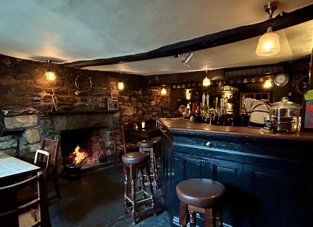
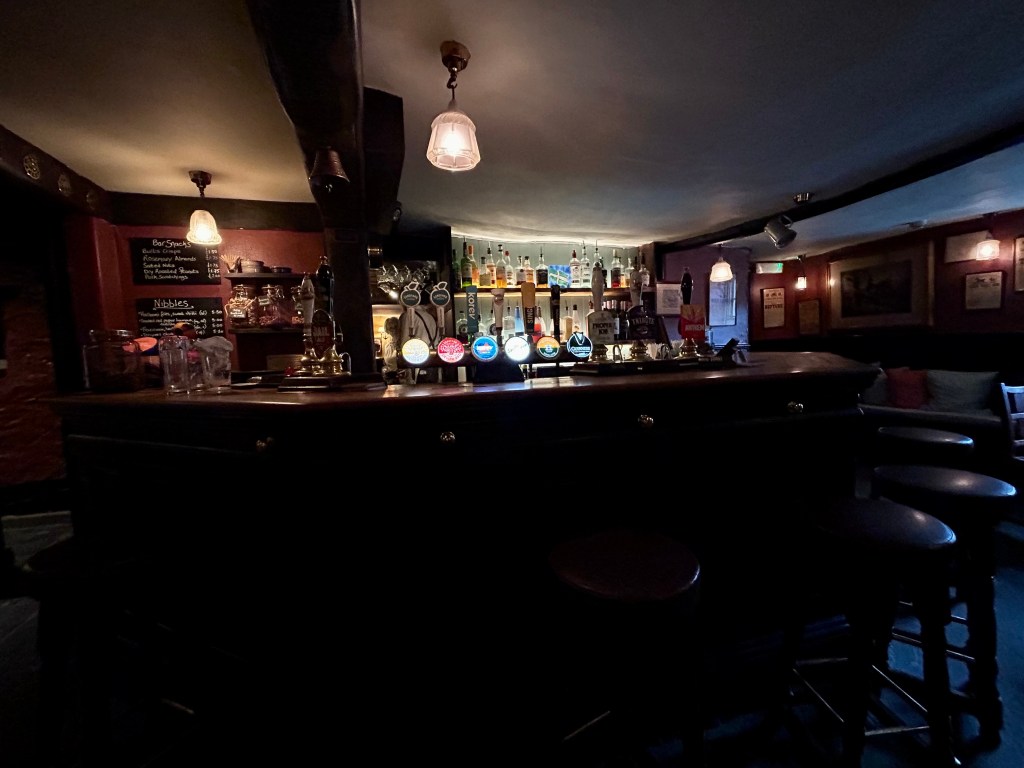
After quenching our thirst for ancient history, it’s time to visit the pub to quench a different thirst. The Castle is a lovely unspoilt 16th century inn with cosy, well-stocked bars, low ceilings and a roaring fire in winter. What’s not to like?
The principal sources I’ve used in researching this series of Dartmoor OTHHs are set out in the introductory blog.
DISCLAIMER
I can take no responsibility for any loss or injury caused by following the above walk. The description is an accurate outline of the route and should enable you to follow the walk on an OS map, but the walk should not be attempted without a map, compass and the ability to use them!
Discover more from Over the hill - on Dartmoor & in Lakeland. I
Subscribe to get the latest posts sent to your email.
