A NEWLANDS ROUND
A horseshoe walk through Cumbria’s industrial past, with some world class mountain views.
On our June trip to the Lakes, I’d expected to stroll round a few pleasant, undemanding rambles. Imagine my surprise when Pat announced that she fancied testing herself on the Newlands Round, a walk we’d not done for a few years and one that I’d had no plans to do again. Admittedly – although a classic Lakeland “round” – the walk is no “Bob Graham Round”: however, for us every passing year makes once easy, straightforward walks more challenging, so the prospect was still a daunting one.
There are various, longer versions of this walk adding one or both of Catbells and Robinson, but we decided to keep it simple (and shorter) and follow the walk described in “Fellwalking with Wainwright” by that most celebrated chronicler of Lakeland fell-walks. We are nothing if not purists: but we are also people who these days don’t actively seek out the toughest routes where easier options are available.
Many descriptions of this walk take you clockwise round the circuit, but I’ve always done it in the opposite direction (as described by Wainwright), in order to get the steepest and rockiest parts of the route over with while still relatively fresh.
Whichever way you do it, you’ll be rewarded with some of the finest views from any fell-walk, as well as several reminders of the area’s industrial past.
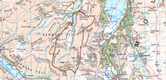
| START/ FINISH | Little Town, in the small parking area near the bridge at OS GR NY232194. If that’s full, there is a car park with a nice café at Littletown Farm, a few hundred yards before the bridge at GR 235196. |
| DISTANCE | 8 miles |
| ASCENT | 2,762ft |
| TERRAIN | A little mild scrambling up Hindscarth, otherwise generally good going, on well managed paths. |
| PUB | The Swinside Inn (GR 243217) |
….. a sweet arcadia……lonely and secluded, an idyllic place of flowers and trees, of emerald pastures and sequestered farmsteads, all cosily sheltered by rough mountains…..
Alfred Wainwright – Fellwalking with Wainwright
AW wasn’t wrong and the valley still has a remote, forgotten feel about it: whether you park at Little Town or by Chapel Bridge you’ll not fail to be struck by the majesty of the imposing fells surrounding you as you prepare for the rigours ahead in the (hopefully) still morning air.
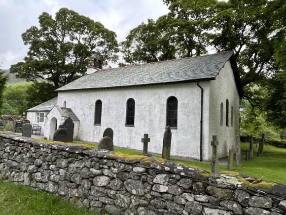
After crossing Chapel Bridge we soon reach Newlands Church on our right. The church dates from the 16th century, but by the 1800’s had fallen into disrepair. In the 1840’s it was reroofed and a new school built, which operated continuously until its closure in 1967.
We leave the road on a track across from the church, crossing the fields to Low Snab farm. After passing the farm we leave the track on a path that doubles back heading uphill to the end of the ridge (GR 228187). Turn left here for the start of the long ascent of a fine path that, after much huffing, puffing and quite possibly cursing, will eventually take us to the top of Hindscarth.
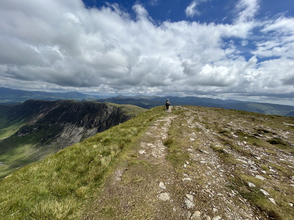
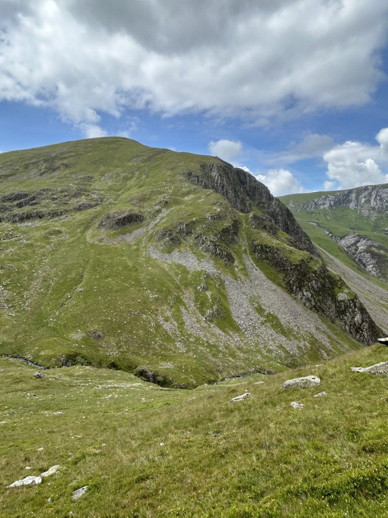
The ridge path climbs steeply to the subsidiary summit of Scope End. This is the site of one of the most important disused mines in the Lake District, The Goldscope Mine: the mine appears on the National Heritage List and is a protected national monument. There are records of gold, silver, copper and lead being mined here in the 13th century. These early efforts employed quite rudimentary methods, but in 1564 large scale, skilled working began, overseen by German miners. ‘Goldscope’ is a corruption of the original German name, ‘Gottesgab’, or ‘god’s gift’.
The fortunes of the mine ebbed and flowed over the years, with lead gradually giving way to copper in the 19th century. In 1920 the mine ceased operating when it became uneconomic to pump out the extremely deep shafts. Spoil heaps and “pan holes” provide surface evidence of times past but standing on this exhilarating ridge on a calm sunny day it’s hard to really appreciate the centuries of hard labour that went on beneath our feet or the complex network of shafts and passages that honeycomb the whole width of the ridge.
For those interested in exploring the history of mining in Cumbria I would recommend a visit to Threlkeld Mining Museum, where you’ll find a clear and nicely presented exhibition. You can also enjoy a ride on a little steam train and examine the plethora of old excavators that are stored here: they are owned by the Vintage Excavation Trust or by individual members of the Trust.
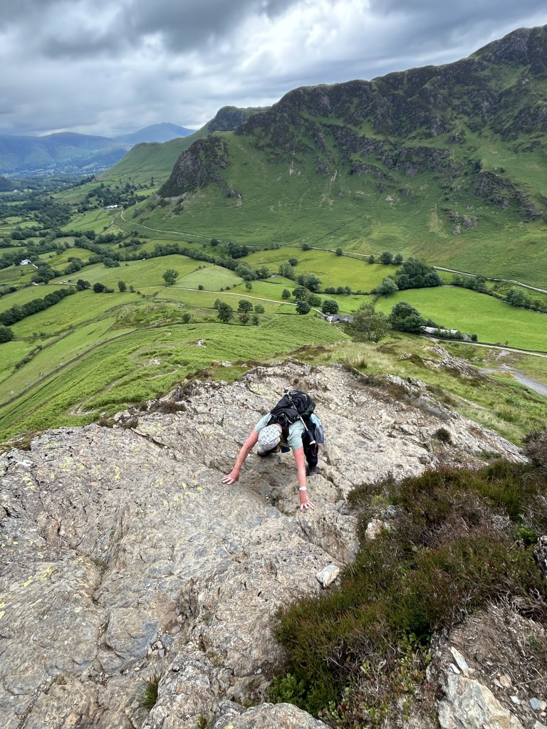
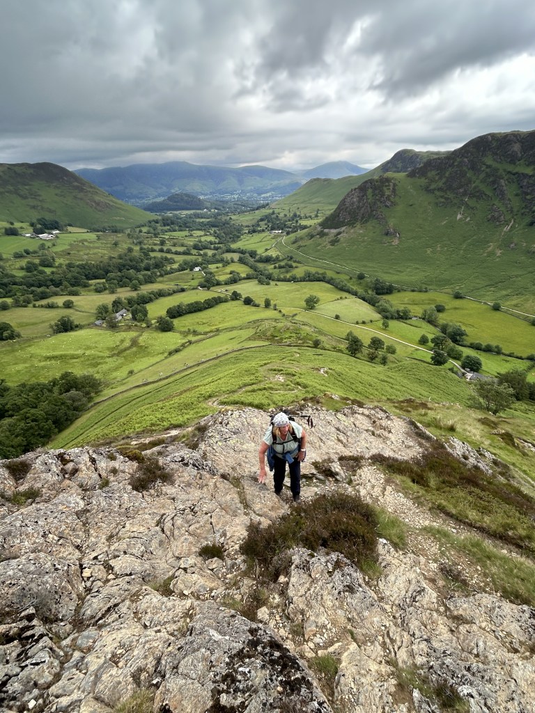
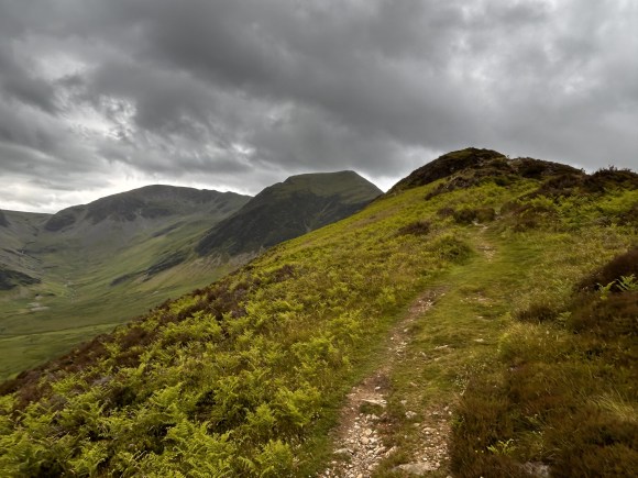
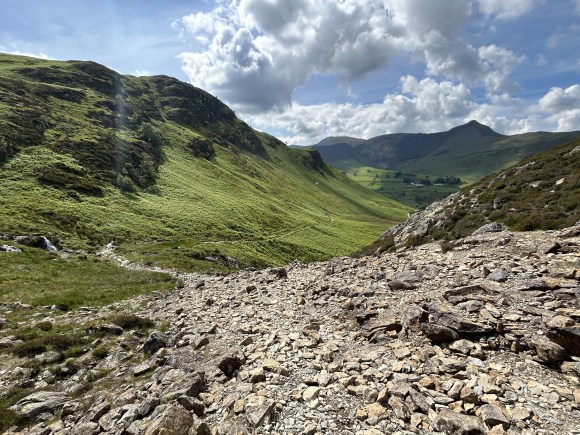
After leaving Scope End, we get our breath back and enjoy a pleasant, heather covered and mercifully easy promenade above Littledale Crags. Just after passing a small tarn on our left, we commence the last steep push up Hindscarth: though tough on our aging legs, this is fell walking at its best and includes a little gentle scrambling over craggy outcrops. The imposing bulk of Robinson dominates the view to our right beyond cliffs that drop away dramatically into the valley and after crossing a little loose rock on the final section the gradient eases and at long last we finally reach the summit.
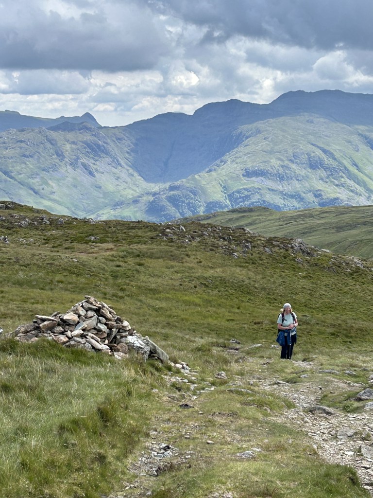
After a long, tiring climb, the actual summit cairn is a disappointment: but the large cairn cum wind shelter around 200 yards away on the broad summit plateau is far more pleasing. We needed no encouragement to stop here for refreshment.
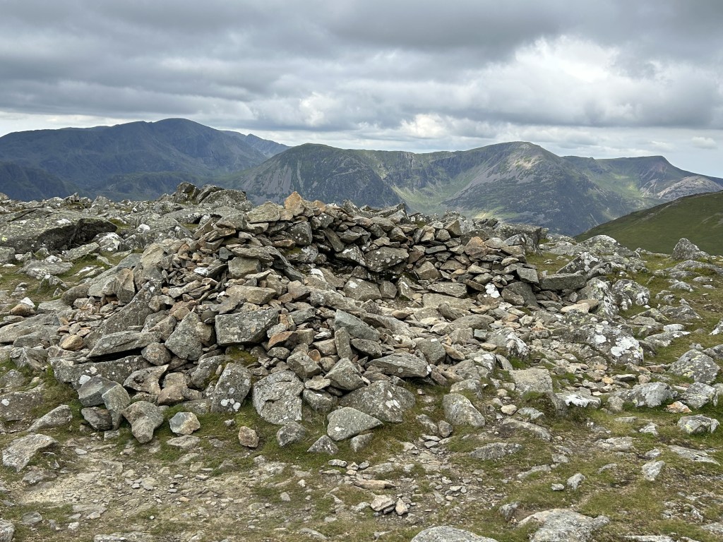
The view from the summit is superb in all directions and includes the Skiddaw group to the north and the imposing Helvellyn ridge to the east. Impressive by any standards but, amazingly, not the best view we’ll see today.
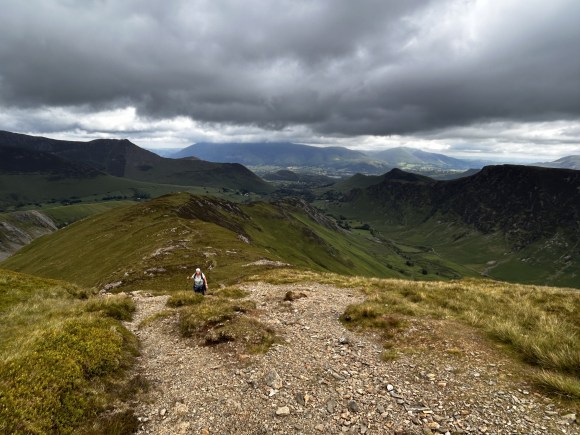
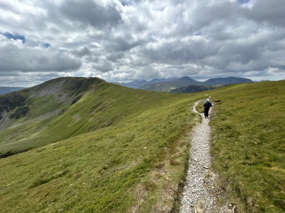
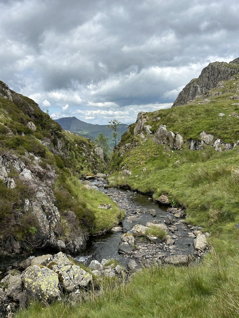
With Hindscarth Crags falling away into the valley on our left, we walk down towards Hindscarth Edge. Taking the left of the two descending tracks we reach the edge and turn left to enjoy an exhilarating traverse before the path rises steeply for the climb to Dale Head. On the ascent we steal tantalising glimpses into the dramatic gully of Far Tongue Ghyll to our left.
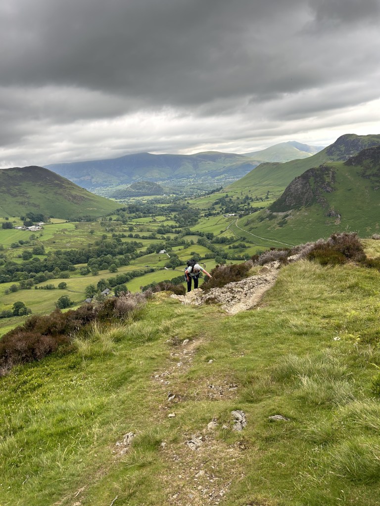
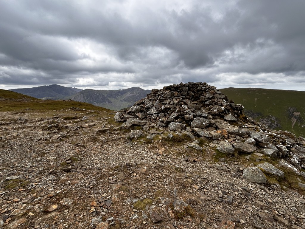
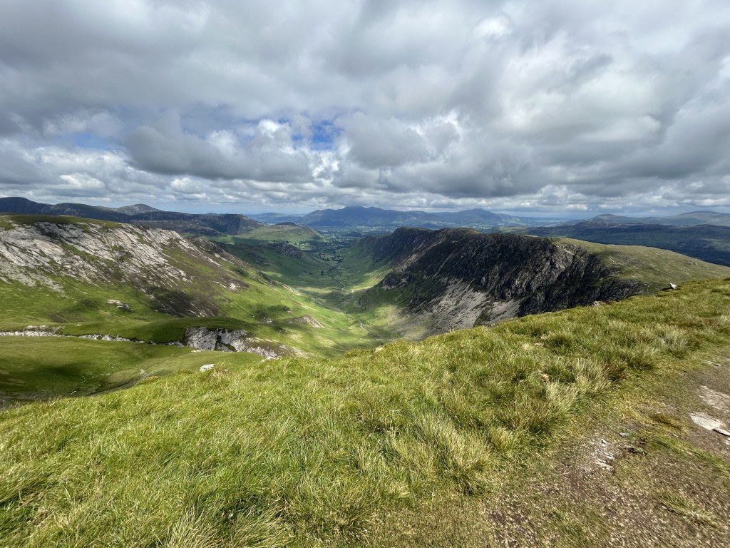
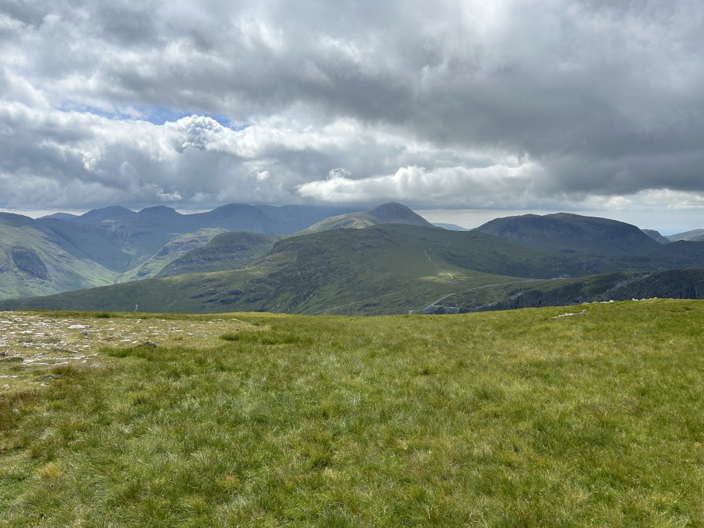
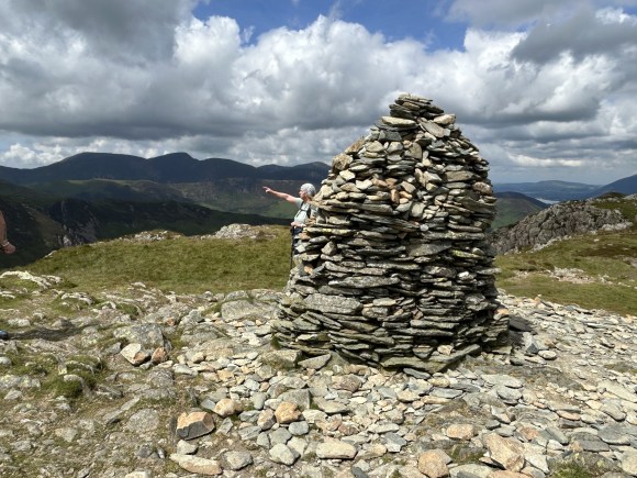
The summit of Dale Head marks the turning point of our walk and provides our best viewpoint, one of the finest in Lakeland, as well as one of it’s most imposing cairns perched on the brink of the sharp drop into Newlands. The backdrop to the magnificent view down the valley is provided by the Skiddaw range and as we revolve to our right – with our jaw slowly dropping – we marvel at Blencathra, Hellvellyn, the Langdale Pikes and the Scafells. Every range bar High Street is visible from here.
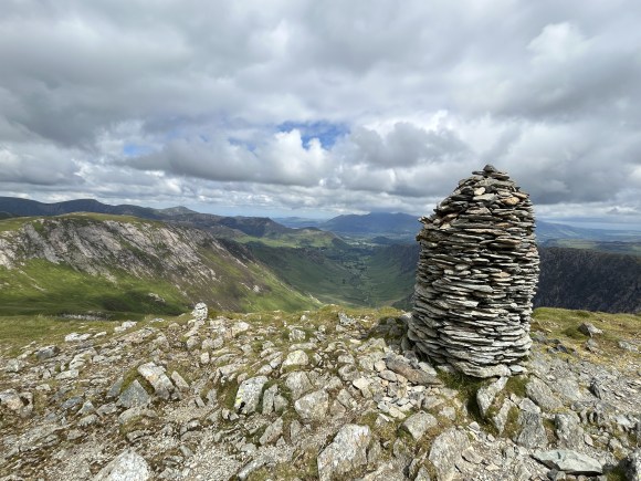
There is more evidence of earlier mining activity hereabouts. To the north, the Dale Head mine was driven below the crags for copper and several levels are still visible. To the south are the extensive underground quarries at Honister, where green slate is still extracted.
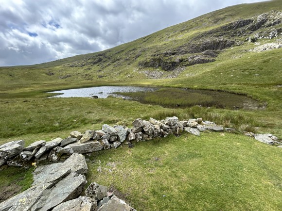
Descend from Dale Head on the steep ridge heading eastwards on a well-marked but steep path that turns right just above Dale Head Crags (at GR 226155) and takes us to Dalehead Tarn. The sheep fold here provides a perfect, sheltered spot for lunch.
Cross Newlands Beck (at GR231152) and take the path, or I should say one of many paths, meandering north eastwards and eventually taking us to High Spy. This climb always seems to take longer than expected as the long and winding path crosses an undulating landscape of ups, downs, mounds, outcrops and false summits. It’s worth it though as the view is almost as good as that from Dale Head: we really are being spoilt on this walk.
The impressive cairn marking the summit of High Spy has been vandalised a few times over the years, but always seems to return quickly to its former glory. The summit marks the crest of a ridge that forms the Borrowdale / Newlands watershed and ends at Catbells.
With the rock climbers’ paradise of Eel Crags falling away precipitously to our left we descend from High Spy and cross Narrow Moor by the path that runs along the western edge of the ridge, giving fine views into the valley, rather than the other path that crosses the centre of the ridge.
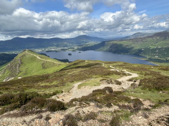
Maiden Moor is a featureless, grassy lump with a summit that is not easy to identify. It fully justifies Wainwright’s description of “undistinguished”. Leave this frankly pathetic “summit” and drop down the ridge to Hause Gate, pausing at a cairn to capture what is one of the best pictures of Derwentwater and Blencathra that you’ll get. At Hause End the ridge path continues ahead to Catbells, but we turn left here for the final descent of the day, back to Little Town.
The route initially follows a rough path that passes the disused Yewthwaite Lead Mine. The mine opened in the late 18th century and closed in 1893. Its spoil heaps, adits and shafts can still be found on the fellside. Beatrix Potter chose the site as the location for her story “The Tale of Mrs Tiggy Winkle”, who was supposed to have lived in one of the holes on the hill above the mine.
After traversing the mine’s spoil heaps the path becomes grassier and following a pleasant stroll on an easier gradient we join the cart track (at GR237193) that takes us back to Little Town, our car and possibly a pint at The Swinside Inn, the only pub in Newlands. The inn offers a traditional bar and a beer garden with panoramic mountain views. A couple of Theakston ales are always on tap plus two changing guest brews.
DISCLAIMER
I can take no responsibility for any loss or injury caused by following the above walk. The description is an accurate outline of the route and should enable you to follow the walk on an OS map, but the walk should not be attempted without a map, compass and the ability to use them!
Discover more from Over the hill - on Dartmoor & in Lakeland. I
Subscribe to get the latest posts sent to your email.
